Sunset, rainbow, moon.
AJSpencer - Wingfoiling |
Tuesday September 19, 2023 5:49 PM |
| Spot | Pat Bay |
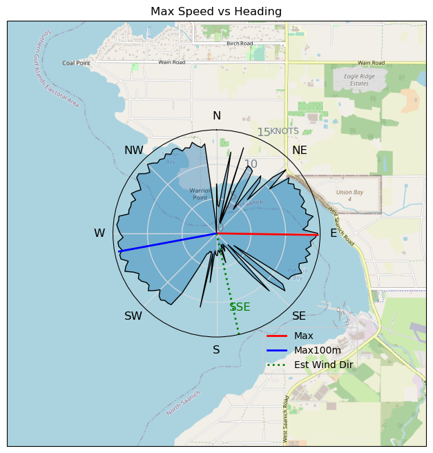
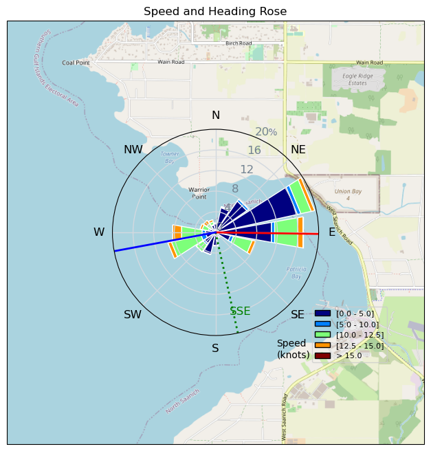
| Conditions | S 10-20, small outside |
| TOW | 1.5 hours |
| Toys | 105 Axis Mast |
| 1010 Axis PNG | |
| 6.5 Duotone Slick | |
| 105 Quatro Wing Drifter | |
| Details | Happy to get out for a better than forecasted SW in Pat Bay. Was off and on here all day. Went out to the inlet where it was South enough for some good fetch up the inlet so some almost rideable waves but not quite enough for me.. Fun trying anyways. Peaked up to about 20 but soon after went South and came off foil. Slogging in I saw the stern of the anchored boat which means SE so I found myself slogging in a SE to get in for quite a while. Better than paddling! Beautiful sky, rainbow, and moon to make the slog all worthwhile. [from Sailing Log on Tuesday September 19, 2023] |
Speed (3s average)
| Speed | knots | km/h |
|---|---|---|
| Avg overall | 5.2 | 9.6 |
| Avg in motion | 7.4 | 13.8 |
| Max | 14.7 | 27.1 |
| Max 100m | 14.2 | 26.3 |
| Max 250m | 13.4 | 24.8 |
| Max 500m | 13.1 | 24.2 |
| Max 2s | 14.5 | 26.8 |
| Max 10s | 14.3 | 26.6 |
| Max Alpha (500/50m) | 9.7 | 18.1 |
| Avg Foiling | 11.2 | 20.7 |
Times and Duration
| Start | Tue Sep 19, 5:49 PM |
| End | Tue Sep 19, 7:20 PM |
| Duration | 01:31:39 |
| In motion | 01:04:14 |
| Paused (< 3 km/h) | 00:26:33 |
| Foiling | 00:34:14 |
| Not Foiling (< 8 km/h) | 00:56:33 |
| Last Calculated | Tue Sep 19, 8:35 PM |
Track Information
| Distance | 14.7 km |
| # Trackpoints | 5442 |
| Avg Trackpoint distance | 2.7 m |
| Number of Turns | 29 |
| Foiling Turns (> 8 km/h) | 3 |
| Foiling Turn Percentage | 10% |


Category: Wingfoiling
one year ago

Created one year ago
AJSpencer |
Please register/login to download this track.
This track was downloaded 0 time(s). |
Please wait while loading suggestions..
Please wait while loading suggestions..
You must login to post comments.