231119 Willows
Highrocker - Wingfoiling |
Sunday November 19, 2023 10:30 AM |
| Spot | Willows Bch |
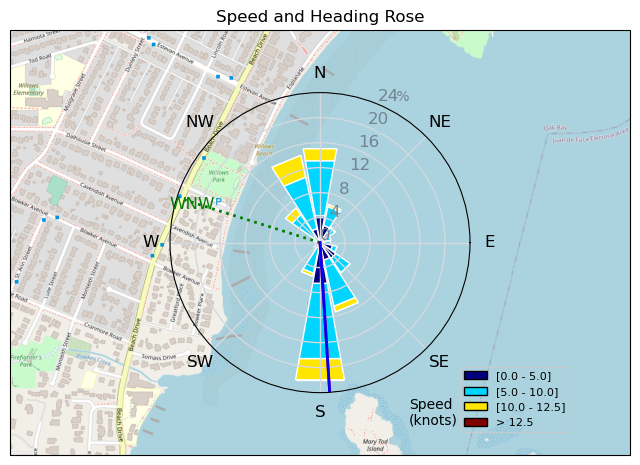
| Conditions | WSW 13-25, Mostly flat |
| TOW | 2.5 hours |
| Toys | 2050sqcm Axis 1020mm Carbon Front Wing |
| 750mm Axis Aluminum Mast | |
| 6.2m Cabrinha Mantis | |
| 115L JP Australia Foil Pro | |
| Details | Gorgeous 2 sessions with Greg and Paul. Bobson came in later and rode out of CP. I was too chicken to exit the bay with the offshore winds to join him. The usual gusty, holey Willows character conditions. Routinely OP'd with the 6.2m, but it let get through the holes on foil. Just missed Gautam's afternoon session. I may have missed the RB epicness, but I gained some Willows sweetness. Sadly I forgot to switch on my GPS for the 2nd session. [from Session Log on Sunday November 19, 2023] |
Speed (3s average)
| Speed | knots | km/h |
|---|---|---|
| Avg overall | 5.7 | 10.5 |
| Avg in motion | 7.1 | 13.2 |
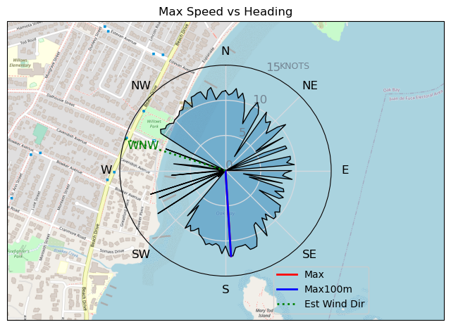
| Max | 12.2 | 22.6 |
| Max 100m | 11.8 | 21.8 |
| Max 250m | 10.9 | 20.2 |
| Max 500m | 10.4 | 19.3 |
| Max 2s | 12.2 | 22.5 |
| Max 10s | 12.0 | 22.2 |
| Max Alpha (500/50m) | 10.4 | 19.2 |
| Avg Foiling | 8.5 | 15.7 |
Times and Duration
| Start | Sun Nov 19, 10:30 AM |
| End | Sun Nov 19, 11:57 AM |
| Duration | 01:26:19 |
| In motion | 01:08:42 |
| Paused (< 3 km/h) | 00:13:22 |
| Foiling | 00:50:59 |
| Not Foiling (< 8 km/h) | 00:31:05 |
| Longest Foiling Segment | 00:07:11 (1.9 km) |
| Last Calculated | Sun Nov 19, 9:31 PM |
Track Information
| Distance | 15.1 km |
| # Trackpoints | 1364 |
| Avg Trackpoint distance | 11.1 m |
| Number of Turns | 31 |
| Foiling Turns (> 8 km/h) | 25 |
| Foiling Turn Percentage | 81% |


Category: Wingfoiling
one year ago

Created one year ago
Highrocker |
Please register/login to download this track.
This track was downloaded 0 time(s). |
Please wait while loading suggestions..
Please wait while loading suggestions..
You must login to post comments.