Back at Nat II
slake - Wingfoiling |
Thursday August 15, 2024 2:21 PM |
| Spot | Nitinat Lk |
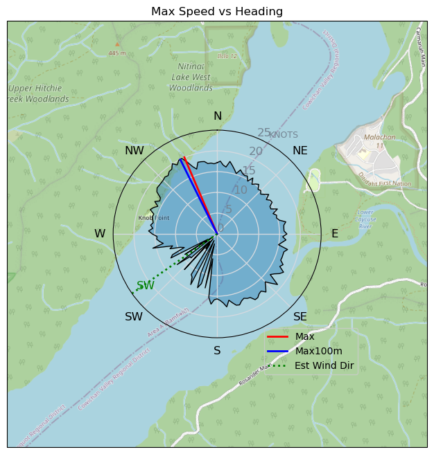
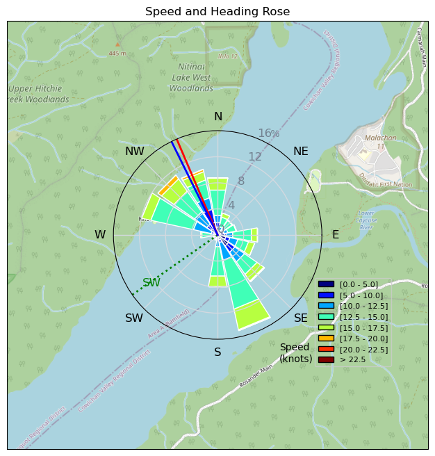
| Conditions | SSW 15-25, 2-3' |
| TOW | 2.3 hours |
| Toys | 3.5m Armstrong XPS |
| 4m Nexen | |
| 5'5" 88L Armstrong Wing SUP | |
| Details | Stronger than yesterday. Working my way further up the lake. How far can one go? It gets so flat. Then not sure if I'll get back on foil once it starts to wind down up there. Seemed better further up than earlier times. Late 6 pm session with 4 m trying downwind 360s, harder in waves, and not consistently hitting them. Can't even imagine trying them non-strong side. Fun times..better wind than the day before. Other half over-powered mid-day on the 3m. Need to get something in the 2.x m range for her, and for me when it is nuking. [from Session Log on Thursday August 15, 2024] |
Speed (3s average)
| Speed | knots | km/h |
|---|---|---|
| Avg overall | 5.8 | 10.7 |
| Avg in motion | 12.7 | 23.6 |
| Max | 20.1 | 37.2 |
| Max 100m | 19.7 | 36.4 |
| Max 250m | 19.1 | 35.5 |
| Max 500m | 17.2 | 31.9 |
| Max 2s | 20.1 | 37.2 |
| Max 10s | 19.7 | 36.4 |
| Max Alpha (500/50m) | 16.0 | 29.6 |
| Avg Foiling | 13.4 | 24.8 |
Times and Duration
| Start | Thu Aug 15, 2:21 PM |
| End | Thu Aug 15, 7:17 PM |
| Duration | 04:56:16 |
| In motion | 02:14:28 |
| Paused (< 3 km/h) | 02:41:11 |
| Foiling | 02:04:47 |
| Not Foiling (< 8 km/h) | 02:50:52 |
| Longest Foiling Segment | 00:35:01 (14.5 km) |
| Last Calculated | Fri Aug 16, 11:08 AM |
Track Information
| Distance | 52.8 km |
| # Trackpoints | 4541 |
| Avg Trackpoint distance | 11.6 m |
| Number of Turns | 91 |
| Foiling Turns (> 8 km/h) | 77 |
| Foiling Turn Percentage | 85% |


Category: Wingfoiling
4 months ago

Created 4 months ago
slake |
Please register/login to download this track.
This track was downloaded 0 time(s). |
Please wait while loading suggestions..
Please wait while loading suggestions..
You must login to post comments.