The day the wind died (and then came back)
slake - Wingfoiling |
Saturday August 31, 2024 12:57 PM |
| Spot | Nitinat Lk |
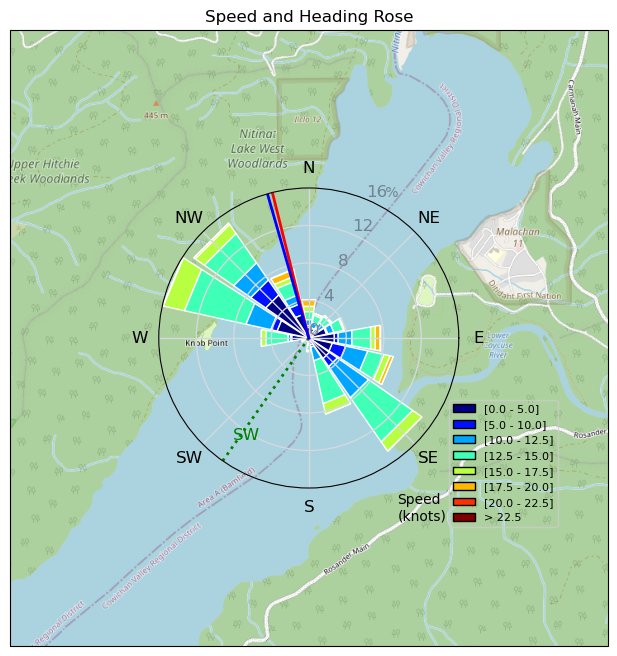
| Conditions | SW 8-16, 1' |
| TOW | 4.0 hours |
| Toys | Armstrong HA925 |
| Armstrong HA1125 | |
| Armstrong HS1850 | |
| 6.1m Armstrong XPS | |
| 5'5" 88L Armstrong Wing SUP | |
| 5'8" 110L Fanatic Sky Wing | |
| Details | How can I even remember two days ago? Used my partner's board to start (she wasn't going out until it got windier), a tad early on the water (taxied for almost 45 min), 6.1 m + HS1850. Eventually going in light air. Swapped to 88 L , good session, then wind died around 4 pm. Every kite was in the water and nobody was wing foiling...except...ULR out-of-nowhere with a big grin, purple wing, green board ripping it! Went back out eventually with big board for a later, light wind, session. Packed it in, was glassy, then windy again around 8 pm and one dude, frasermc, was out there rocking it during gorgeous sunset, lake to himself. [from Session Log on Saturday August 31, 2024] |
Speed (3s average)
| Speed | knots | km/h |
|---|---|---|
| Avg overall | 7.6 | 14.1 |
| Avg in motion | 10.7 | 19.7 |
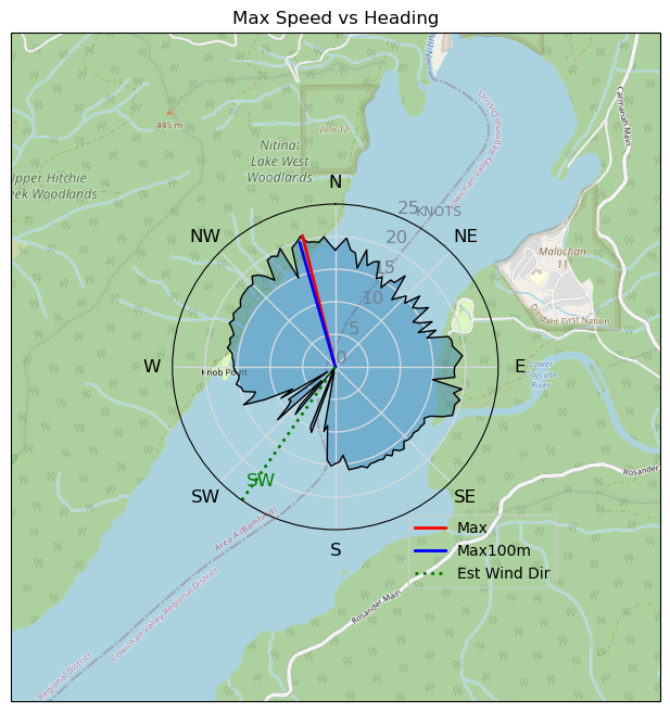
| Max | 20.7 | 38.4 |
| Max 100m | 20.1 | 37.2 |
| Max 250m | 19.7 | 36.4 |
| Max 500m | 19.2 | 35.6 |
| Max 2s | 20.7 | 38.4 |
| Max 10s | 20.1 | 37.2 |
| Max Alpha (500/50m) | 14.3 | 26.4 |
| Avg Foiling | 13.1 | 24.2 |
Times and Duration
| Start | Sat Aug 31, 12:57 PM |
| End | Sat Aug 31, 5:57 PM |
| Duration | 05:00:15 |
| In motion | 03:34:58 |
| Paused (< 3 km/h) | 01:24:53 |
| Foiling | 02:42:33 |
| Not Foiling (< 8 km/h) | 02:17:18 |
| Longest Foiling Segment | 00:33:47 (15.1 km) |
| Last Calculated | Sun Sep 01, 9:24 PM |
Track Information
| Distance | 70.7 km |
| # Trackpoints | 5828 |
| Avg Trackpoint distance | 12.1 m |
| Number of Turns | 138 |
| Foiling Turns (> 8 km/h) | 117 |
| Foiling Turn Percentage | 85% |


Category: Wingfoiling
3 months ago

Created 3 months ago
slake |
Please register/login to download this track.
This track was downloaded 0 time(s). |
Please wait while loading suggestions..
Please wait while loading suggestions..
You must login to post comments.