1050 test runs
UnusuallyLargeRobin - Wingfoil |
Saturday January 28, 2023 12:18 PM |
| Spot | Cattle Pt |
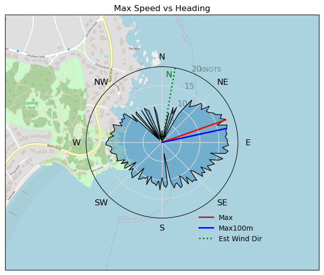
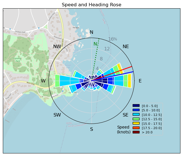
| Conditions | NNE 15-20, flattish |
| TOW | 2.5 hours |
| Toys | 425 P Axis Rear Foil/Stab |
| 90cm Axis Alu Mast | |
| Ultrashort (64.3cm) Axis Black Fuselage | |
| 5.5 Duotone Unit | |
| 4.0 Duotone Unit | |
| 75 lt Fanatic Sky Wing 5'0 | |
| Details | Perfect conditions for testing another foil, the Axis HPS 1050. It felt great right from the start, easy to get going and fast! No issues, turning, tacking, cranking on it. I likey!! Changed down to 4.0m to see how that was. Foil kept me going even though there was quite a few holey areas, nice! Need to have another session to check some things but overall impressed with it. Tweezer finally showed up and lead me into temptation and the sea of doom (aka Baynes channel over by Discovery) A major river running, big boily thingys, whirlpool like things, elevator bulges out of nowhere! On the downwind return portion seemed like no wind but we were flying by the land. Watch battery died so a shortened gps log [from Sailing Log on Saturday January 28, 2023] |
Speed (3s average)
| Speed | knots | km/h |
|---|---|---|
| Avg overall | 6.3 | 11.6 |
| Avg in motion | 9.9 | 18.2 |
| Max | 17.8 | 33.0 |
| Max 100m | 17.6 | 32.5 |
| Max 250m | 15.4 | 28.6 |
| Max 500m | 14.1 | 26.1 |
| Max 2s | 17.8 | 33.0 |
| Max 10s | 17.6 | 32.6 |
| Max Alpha (500/50m) | 12.9 | 23.9 |
| Avg Foiling | 11.2 | 20.7 |
Times and Duration
| Start | Sat Jan 28, 12:18 PM |
| End | Sat Jan 28, 1:31 PM |
| Duration | 01:13:26 |
| In motion | 00:46:41 |
| Paused (< 3 km/h) | 00:23:13 |
| Foiling | 00:37:54 |
| Not Foiling (< 8 km/h) | 00:32:00 |
| Last Calculated | Sat Jan 28, 4:34 PM |
Track Information
| Distance | 14.2 km |
| # Trackpoints | 2477 |
| Avg Trackpoint distance | 5.7 m |
| Number of Turns | 77 |
| Foiling Turns (> 8 km/h) | 45 |
| Foiling Turn Percentage | 58% |


Category: Wingfoiling
2 years ago

Created 2 years ago
UnusuallyLargeRobin |
Please register/login to download this track.
This track was downloaded 0 time(s). |
| 33 241120 Willows |
| 40 Willows Bomb Session |
| 41 Shoot the Entrance |
| 32 CloverPartDeux |
| 24 Come back soon Bombo |
Please wait while loading suggestions..
Please wait while loading suggestions..
You must login to post comments.