Reefable wing required
AJSpencer - Wingfoiling |
Monday October 16, 2023 2:48 PM |
| Spot | Pat Bay |
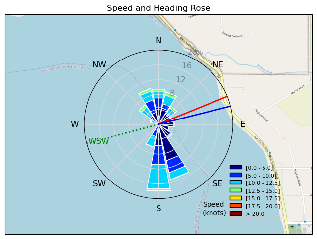
| Conditions | WNW 10-40, Mixed, some ride |
| TOW | 2.0 hours |
| Toys | 105 Axis Mast |
| 1010 Axis PNG | |
| 5.0 KT Jus D???orange DD | |
| 105 Quatro Wing Drifter | |
| Details | Struggled to make a decision on wing size. Forecast was for 6.5m, conditions when it filled in were 4m, but logic was 5m. Went with 5m in the middle but no wing was the right choice today. Got going and a little while later saw a wall of white on the water in the inlet so braced for impact. Survival for a while. Found it was best to be on knees and reach across with mostly flogged wing. Fortunately newer wing so not so floggy. Died down and then roared back same thing. Settled in for a while and occasional fun wave assisted speed runs and s turns. Kiter showed up so it tanked to 10g20 with only short bursts of 20. Craziest wind I've seen there I think. Nice to be back out there. Out of shape again. [from Sailing Log on Monday October 16, 2023] |
Speed (3s average)
| Speed | knots | km/h |
|---|---|---|
| Avg overall | 4.7 | 8.6 |
| Avg in motion | 7.9 | 14.6 |
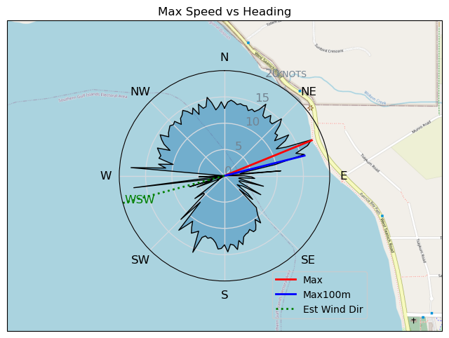
| Max | 17.9 | 33.2 |
| Max 100m | 14.9 | 27.5 |
| Max 250m | 13.1 | 24.3 |
| Max 500m | 12.5 | 23.1 |
| Max 2s | 17.9 | 33.1 |
| Max 10s | 15.5 | 28.8 |
| Max Alpha (500/50m) | 9.8 | 18.1 |
| Avg Foiling | 10.2 | 18.9 |
Times and Duration
| Start | Mon Oct 16, 2:48 PM |
| End | Mon Oct 16, 5:07 PM |
| Duration | 02:19:03 |
| In motion | 01:22:11 |
| Paused (< 3 km/h) | 00:55:55 |
| Foiling | 00:53:45 |
| Not Foiling (< 8 km/h) | 01:24:21 |
| Longest Foiling Segment | 00:03:16 (1.2 km) |
| Last Calculated | Mon Oct 16, 6:00 PM |
Track Information
| Distance | 20.0 km |
| # Trackpoints | 6433 |
| Avg Trackpoint distance | 3.1 m |
| Number of Turns | 68 |
| Foiling Turns (> 8 km/h) | 0 |
| Foiling Turn Percentage | 0% |


Category: Wingfoiling
one year ago

Created one year ago
AJSpencer |
Please register/login to download this track.
This track was downloaded 0 time(s). |
Please wait while loading suggestions..
Please wait while loading suggestions..
You must login to post comments.