Air Time
TunaCan - Wingfoiling |
Saturday December 02, 2023 12:23 PM |
| Spot | Ross Bay |
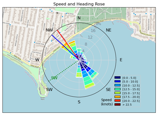
| Conditions | WSW 14-22, 1-2 |
| TOW | 1.3 hours |
| Toys | 5 OR GLIDE |
| 5'3 Takuma TK 80 | |
| Details | Arrived for the late shift. Was full of energy and spent a decent amount of time on the inside and lighter wind trying to land a Flaka. Couldnt do it after about 20 - came close once or twice. Went to the outside and sent a few big ones and finally got one. Great session - fully powered and might have something new cooking! Maybe 3 days in a row tomorrow? [from Session Log on Saturday December 02, 2023] |
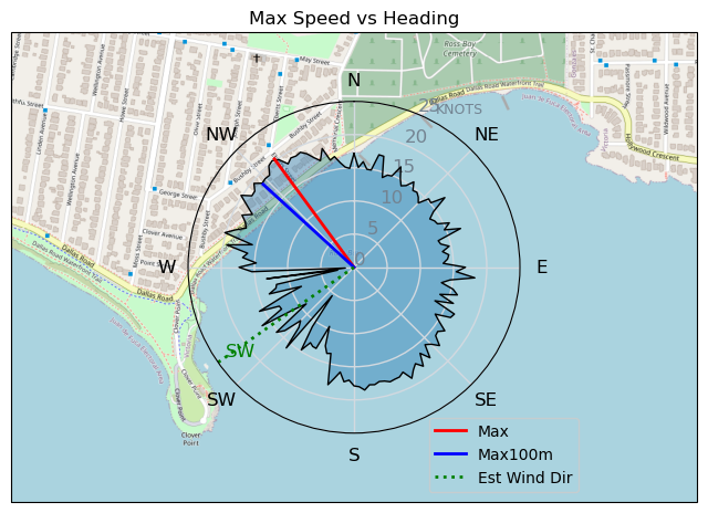
Speed (3s average)
| Speed | knots | km/h |
|---|---|---|
| Avg overall | 8.2 | 15.2 |
| Avg in motion | 10.7 | 19.7 |
| Max | 20.3 | 37.5 |
| Max 100m | 18.5 | 34.2 |
| Max 250m | 16.5 | 30.6 |
| Max 500m | 15.3 | 28.4 |
| Max 2s | 20.2 | 37.4 |
| Max 10s | 18.6 | 34.4 |
| Max Alpha (500/50m) | 15.3 | 28.4 |
| Avg Foiling | 12.6 | 23.4 |
Times and Duration
| Start | Sat Dec 02, 12:23 PM |
| End | Sat Dec 02, 1:59 PM |
| Duration | 01:35:45 |
| In motion | 01:13:44 |
| Paused (< 3 km/h) | 00:21:01 |
| Foiling | 00:57:08 |
| Not Foiling (< 8 km/h) | 00:37:37 |
| Longest Foiling Segment | 00:03:41 (1.5 km) |
| Last Calculated | Sat Dec 02, 8:05 PM |
Track Information
| Distance | 24.3 km |
| # Trackpoints | 5422 |
| Avg Trackpoint distance | 4.5 m |
| Number of Turns | 156 |
| Foiling Turns (> 8 km/h) | 71 |
| Foiling Turn Percentage | 46% |


Category: Wingfoiling
12 months ago

Created 12 months ago
TunaCan |
Please register/login to download this track.
This track was downloaded 0 time(s). |
Please wait while loading suggestions..
Please wait while loading suggestions..
You must login to post comments.