231219 Cattle Point
Highrocker - Wingfoiling |
Tuesday December 19, 2023 12:44 PM |
| Spot | Cattle Pt |
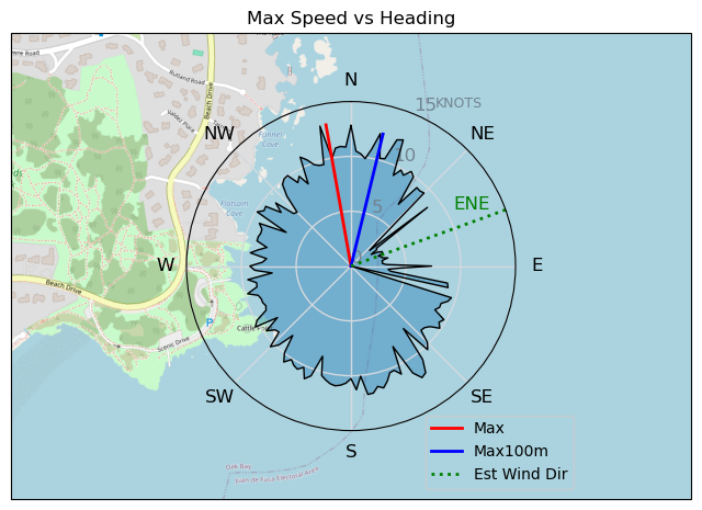
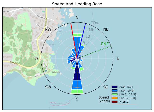
| Conditions | ESE 12-20, chop to 0.5m swell |
| TOW | 1.0 hours |
| Toys | 900mm Axis Aluminum Mast |
| 2050sqcm Axis 1020mm Carbon Front Wing | |
| 6.2m Cabrinha Mantis | |
| 115L JP Australia Foil Pro | |
| Details | So nice when you take the shot and you score! Bonus 8/10 session with Bobson, Danno, Rupp-Dog. Started fairly marginal NW that peaked to a 21kt SE (from Cad wx station) for a wild 15min period. I was able to do my S-Turn thing 200m from CP and was fully powered without risk of being becalmed in the shipping lanes. Played gybe tag with Danno resulting in some epic crashes for me! What a fantastic early Christmas gift from the wind Santa. Just the fix I needed for my recent withdrawal symptoms. [from Session Log on Tuesday December 19, 2023] |
Speed (3s average)
| Speed | knots | km/h |
|---|---|---|
| Avg overall | 4.7 | 8.8 |
| Avg in motion | 7.7 | 14.3 |
| Max | 13.1 | 24.2 |
| Max 100m | 12.5 | 23.1 |
| Max 250m | 10.5 | 19.4 |
| Max 500m | 10.1 | 18.7 |
| Max 2s | 13.1 | 24.2 |
| Max 10s | 12.8 | 23.6 |
| Max Alpha (500/50m) | 9.8 | 18.2 |
| Avg Foiling | 8.6 | 16.0 |
Times and Duration
| Start | Tue Dec 19, 12:44 PM |
| End | Tue Dec 19, 1:52 PM |
| Duration | 01:08:45 |
| In motion | 00:42:17 |
| Paused (< 3 km/h) | 00:20:35 |
| Foiling | 00:34:38 |
| Not Foiling (< 8 km/h) | 00:28:14 |
| Longest Foiling Segment | 00:07:48 (2.1 km) |
| Last Calculated | Tue Dec 19, 11:14 PM |
Track Information
| Distance | 10.1 km |
| # Trackpoints | 1367 |
| Avg Trackpoint distance | 7.4 m |
| Number of Turns | 43 |
| Foiling Turns (> 8 km/h) | 29 |
| Foiling Turn Percentage | 67% |


Category: Wingfoiling
12 months ago

Created 12 months ago
Highrocker |
Please register/login to download this track.
This track was downloaded 0 time(s). |
Please wait while loading suggestions..
Please wait while loading suggestions..
You must login to post comments.