240120 Cattle Point
Highrocker - Wingfoiling |
Saturday January 20, 2024 1:22 PM |
| Spot | Cattle Pt |
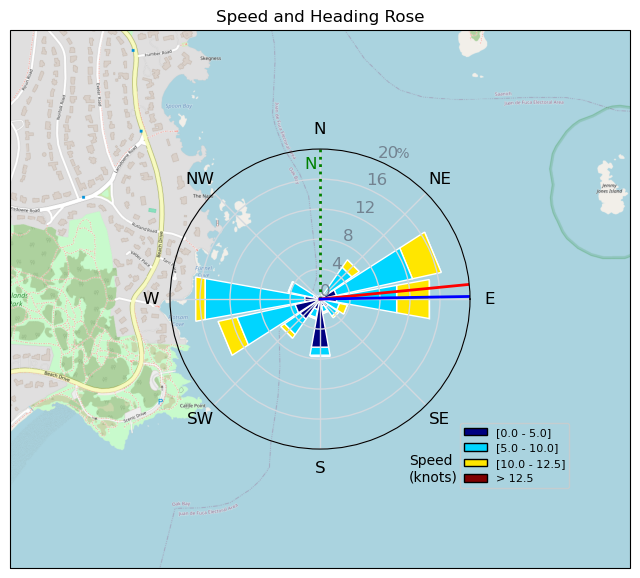
| Conditions | NE 9-15, chop to 1ft swell |
| TOW | 1.5 hours |
| Toys | 900mm Axis Aluminum Mast |
| 2050sqcm Axis 1020mm Carbon Front Wing | |
| 6.2m Cabrinha Mantis | |
| 115L JP Australia Foil Pro | |
| Details | My OSR to the OGs was for marginal conditions that I was feeling onshore. Then, I made it out to the yellow buoy and it was ON! Continually powered up making for easier, repeated gybes and carves. Great to have Bobson whoopin' past me at mach 21(kts), TunaCan rippin' 360s around the buoy, Greg going up and down! I was just leaving as Twizzler and the Good Dr came out to play. Some of the best sessions are the ones that where you have low expectations, then you get gifted! [from Session Log on Saturday January 20, 2024] |
Speed (3s average)
| Speed | knots | km/h |
|---|---|---|
| Avg overall | 6.5 | 12.1 |
| Avg in motion | 7.9 | 14.6 |
| Max | 12.2 | 22.5 |
| Max 100m | 11.6 | 21.5 |
| Max 250m | 11.4 | 21.0 |
| Max 500m | 10.5 | 19.5 |
| Max 2s | 12.0 | 22.3 |
| Max 10s | 11.9 | 22.0 |
| Max Alpha (500/50m) | 9.9 | 18.4 |
| Avg Foiling | 8.6 | 15.9 |
Times and Duration
| Start | Sat Jan 20, 1:22 PM |
| End | Sat Jan 20, 2:54 PM |
| Duration | 01:32:10 |
| In motion | 01:16:48 |
| Paused (< 3 km/h) | 00:13:13 |
| Foiling | 01:05:39 |
| Not Foiling (< 8 km/h) | 00:24:22 |
| Longest Foiling Segment | 00:10:50 (2.8 km) |
| Last Calculated | Sun Jan 21, 12:02 AM |
Track Information
| Distance | 18.6 km |
| # Trackpoints | 1474 |
| Avg Trackpoint distance | 12.6 m |
| Number of Turns | 48 |
| Foiling Turns (> 8 km/h) | 36 |
| Foiling Turn Percentage | 75% |


Category: Wingfoiling
11 months ago

Created 11 months ago
Highrocker |
Please register/login to download this track.
This track was downloaded 0 time(s). |
Please wait while loading suggestions..
Please wait while loading suggestions..
You must login to post comments.