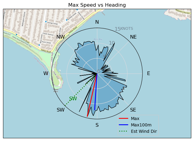
20240529
ThePope - Wingfoiling |
Wednesday May 29, 2024 2:14 PM |
| Spot | Ross Bay |
| Conditions | WSW 15-30, 0.5m-1m |
| TOW | 1.5 hours |
| Toys | Popemobile |
| 300V2 Armstrong CF | |
| 70 Armstrong Fuse | |
| 1475 Armstrong MA | |
| 4m Duotone Unit | |
| 5.5m Duotone Unit | |
| 99L Armstrong FG Wing SUP | |
| Details | Mixed bag session at RB, but a gorgeous and sunny afternoon. A group of orcas swam right past Clover just a few hours earlier! When I arrived at the beach Gus said 5.5m, Lance said 4m -- both were right. Up and down winds were challenging, and the leaky strut bladder on my 5.5m made things feel a bit flopsy. Hopefully the replacement arrives soon. Waited out a lull with with BWD, Rupert, Gus, Rob, Danno, and Windjunky, then headed back out on the 5.5m for a bit. Post session debrief with Bobson and H-Rock! [from Session Log on Wednesday May 29, 2024] |
Speed (3s average)
| Speed | knots | km/h |
|---|---|---|
| Avg overall | 3.0 | 5.5 |
| Avg in motion | 6.2 | 11.5 |
| Max | 14.4 | 26.7 |
| Max 100m | 12.4 | 22.9 |
| Max 250m | 11.6 | 21.4 |
| Max 500m | 10.7 | 19.8 |
| Max 2s | 14.2 | 26.3 |
| Max 10s | 12.5 | 23.1 |
| Max Alpha (500/50m) | 8.1 | 15.0 |
| Avg Foiling | 8.4 | 15.5 |
Times and Duration
| Start | Wed May 29, 2:14 PM |
| End | Wed May 29, 4:32 PM |
| Duration | 02:18:13 |
| In motion | 01:05:51 |
| Paused (< 3 km/h) | 01:11:29 |
| Foiling | 00:36:10 |
| Not Foiling (< 8 km/h) | 01:41:10 |
| Longest Foiling Segment | 00:03:01 (904 m) |
| Last Calculated | Wed May 29, 8:13 PM |
Track Information
| Distance | 12.6 km |
| # Trackpoints | 3321 |
| Avg Trackpoint distance | 3.8 m |
| Number of Turns | 18 |
| Foiling Turns (> 8 km/h) | 0 |
| Foiling Turn Percentage | 0% |


Category: Wingfoiling
6 months ago

Created 6 months ago
ThePope |
Please register/login to download this track.
This track was downloaded 0 time(s). |
| 36 241120 Willows |
| 44 Willows Bomb Session |
| 43 Shoot the Entrance |
| 35 CloverPartDeux |
| 25 Come back soon Bombo |
Please wait while loading suggestions..
Please wait while loading suggestions..
You must login to post comments.