240626 Ross Bay
Highrocker - Wingfoiling |
Wednesday June 26, 2024 4:35 PM |
| Spot | Ross Bay |
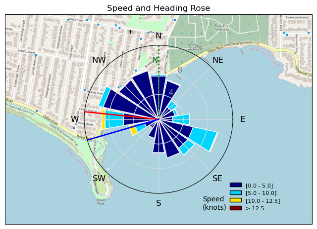
| Conditions | W 9-12, Mostly flat |
| TOW | 0.8 hours |
| Toys | 900mm Axis Aluminum Mast |
| 2050sqcm Axis 1020mm Carbon Front Wing | |
| 6.2m Cabrinha Mantis | |
| 115L JP Australia Foil Pro | |
| Details | I met another hopeful soul, RDog, parked at the Mayor's spot, both of us hoping for the forecast to come true. There was a bit of build up, so we both jumped in to give it a shot. We got a few lifts, but the juice just wasn't worth the squeeze. So much pumping to get up and stay up, even with my big 2000sqcm foil. Eventually it all died off and luckily I was closer to the beach. RDog followed me in a few minutes later. Hoping on Thursday's forecast. Thanks for sharing the slog, RDog! [from Session Log on Wednesday June 26, 2024] |
Speed (3s average)
| Speed | knots | km/h |
|---|---|---|
| Avg overall | 2.7 | 4.9 |
| Avg in motion | 4.8 | 8.9 |
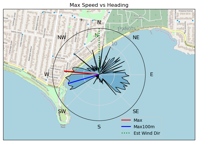
| Max | 11.3 | 20.8 |
| Max 100m | 10.3 | 19.1 |
| Max 250m | 9.9 | 18.3 |
| Max 500m | 9.4 | 17.3 |
| Max 2s | 11.3 | 20.8 |
| Max 10s | 10.8 | 20.0 |
| Max Alpha (500/50m) | 4.6 | 8.6 |
| Avg Foiling | 7.7 | 14.3 |
Times and Duration
| Start | Wed Jun 26, 4:35 PM |
| End | Wed Jun 26, 5:25 PM |
| Duration | 00:50:37 |
| In motion | 00:28:04 |
| Paused (< 3 km/h) | 00:21:44 |
| Foiling | 00:09:35 |
| Not Foiling (< 8 km/h) | 00:40:13 |
| Longest Foiling Segment | 00:04:27 (1.1 km) |
| Last Calculated | Wed Jun 26, 10:07 PM |
Track Information
| Distance | 4.2 km |
| # Trackpoints | 731 |
| Avg Trackpoint distance | 5.7 m |
| Number of Turns | 16 |
| Foiling Turns (> 8 km/h) | 3 |
| Foiling Turn Percentage | 19% |


Category: Wingfoiling
5 months ago

Created 5 months ago
Highrocker |
Please register/login to download this track.
This track was downloaded 0 time(s). |
| 33 241120 Willows |
| 41 Willows Bomb Session |
| 42 Shoot the Entrance |
| 33 CloverPartDeux |
| 25 Come back soon Bombo |
Please wait while loading suggestions..
Please wait while loading suggestions..
You must login to post comments.