20240914
ThePope - Wingfoiling |
Saturday September 14, 2024 4:02 PM |
| Spot | Ross Bay |
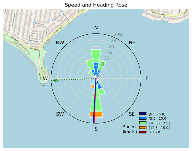
| Conditions | WSW 15-25, 1m |
| TOW | 2.0 hours |
| Toys | 99L Armstrong FG Wing SUP |
| 5.5m Duotone Unit | |
| 7m Duotone Ventis | |
| 1475 Armstrong MA | |
| 1225 Armstrong MA | |
| 70 Armstrong Fuse | |
| 865 Armstrong Mast | |
| 235 Armstrong Flow | |
| Popemobile | |
| Details | Big day at RB! Tons of foilers out. Parawings! Bobson we still love you. Pretty light to start so I spent the first 30 min on my 7m and 1475MA -- I seem to be able to get foiling in really light conditions using this combo lately. The wind picked up so I came in for my 5.5m and switched to 1225MA. That was great for another 45 min, but then the wind picked up more and the last 45 min was pretty OP'd and I was wishing I brought my 4m. Great to see everybody out -- high stoke day! [from Session Log on Saturday September 14, 2024] |
Speed (3s average)
| Speed | knots | km/h |
|---|---|---|
| Avg overall | 6.4 | 11.9 |
| Avg in motion | 9.4 | 17.4 |
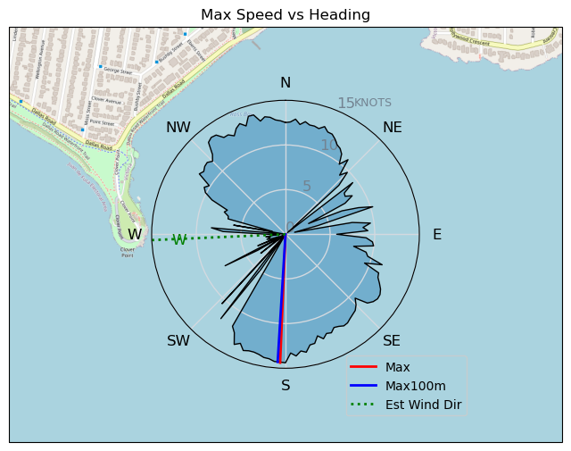
| Max | 14.4 | 26.7 |
| Max 100m | 13.8 | 25.6 |
| Max 250m | 13.5 | 25.0 |
| Max 500m | 13.3 | 24.5 |
| Max 2s | 14.4 | 26.6 |
| Max 10s | 14.0 | 26.0 |
| Max Alpha (500/50m) | 11.4 | 21.1 |
| Avg Foiling | 10.3 | 19.0 |
Times and Duration
| Start | Sat Sep 14, 4:02 PM |
| End | Sat Sep 14, 6:24 PM |
| Duration | 02:22:42 |
| In motion | 01:37:49 |
| Paused (< 3 km/h) | 00:44:49 |
| Foiling | 01:23:35 |
| Not Foiling (< 8 km/h) | 00:59:03 |
| Longest Foiling Segment | 00:03:51 (1.2 km) |
| Last Calculated | Sat Sep 14, 9:32 PM |
Track Information
| Distance | 28.4 km |
| # Trackpoints | 5618 |
| Avg Trackpoint distance | 5.1 m |
| Number of Turns | 19 |
| Foiling Turns (> 8 km/h) | 2 |
| Foiling Turn Percentage | 11% |


Category: Wingfoiling
3 months ago

Created 3 months ago
ThePope |
Please register/login to download this track.
This track was downloaded 0 time(s). |
| 21 241120 Willows |
| 25 Willows Bomb Session |
| 29 Shoot the Entrance |
| 23 CloverPartDeux |
| 13 Come back soon Bombo |
Please wait while loading suggestions..
Please wait while loading suggestions..
You must login to post comments.