241104 Pat Bay
Highrocker - Wingfoiling |
Monday November 04, 2024 1:46 PM |
| Spot | Pat Bay |
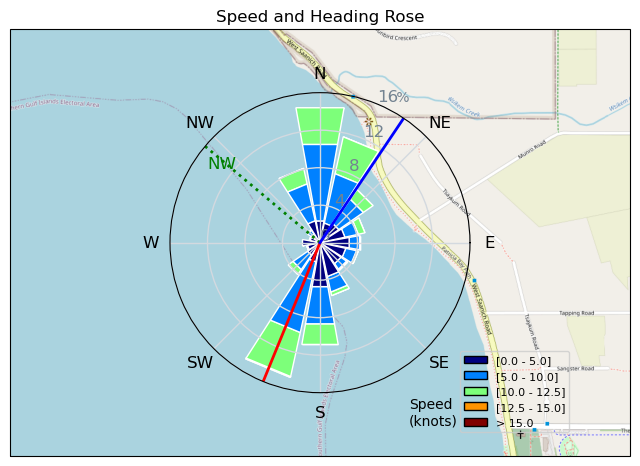
| Conditions | W 12-22, chop to 1ft swell |
| TOW | 1.0 hours |
| Toys | 115L JP Australia Foil Pro |
| 6m Cabrinha X3 Windows | |
| 2050sqcm Axis 1020mm Carbon Front Wing | |
| 900mm Axis Aluminum Mast | |
| Details | After a difficult Cad Bay attempt, I followed GregCan to PB and found some reasonable conditions that matched my low skill/risk averse level. Joined by a group of like-minded OGs including MtnarG, Ben, JohnK, GMan, and a foiler from Kimberley. Tough to get in the water with the stiff onshore winds, so I chose my smaller 6m. Easily got up once past the long shallows, but quickly OP'd the further out I got. Stayed closer in and had a great time shreddin' with the OGs. PB rocks for me! [from Session Log on Monday November 04, 2024] |
Speed (3s average)
| Speed | knots | km/h |
|---|---|---|
| Avg overall | 6.1 | 11.2 |
| Avg in motion | 8.8 | 16.3 |
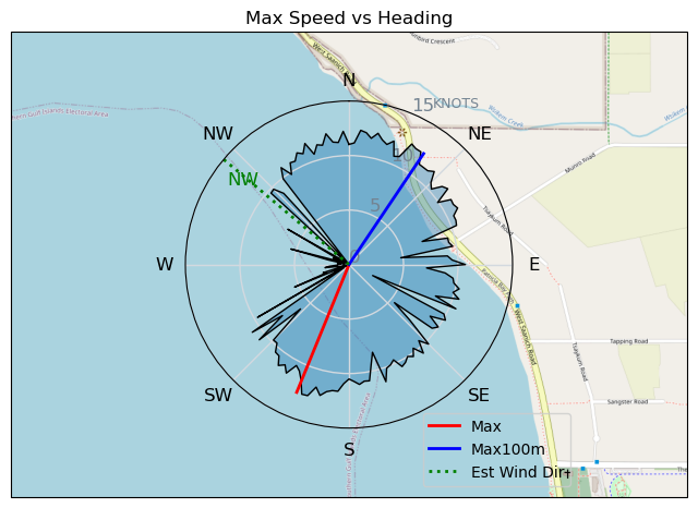
| Max | 12.7 | 23.4 |
| Max 100m | 12.1 | 22.5 |
| Max 250m | 11.7 | 21.7 |
| Max 500m | 11.0 | 20.3 |
| Max 2s | 12.7 | 23.4 |
| Max 10s | 12.4 | 23.0 |
| Max Alpha (500/50m) | 10.5 | 19.4 |
| Avg Foiling | 9.3 | 17.2 |
Times and Duration
| Start | Mon Nov 04, 1:46 PM |
| End | Mon Nov 04, 3:15 PM |
| Duration | 01:28:29 |
| In motion | 01:00:40 |
| Paused (< 3 km/h) | 00:24:52 |
| Foiling | 00:53:59 |
| Not Foiling (< 8 km/h) | 00:31:33 |
| Longest Foiling Segment | 00:12:48 (3.7 km) |
| Last Calculated | Tue Nov 05, 9:54 AM |
Track Information
| Distance | 16.5 km |
| # Trackpoints | 2059 |
| Avg Trackpoint distance | 8.0 m |
| Number of Turns | 44 |
| Foiling Turns (> 8 km/h) | 37 |
| Foiling Turn Percentage | 84% |


Category: Wingfoiling
3 weeks ago

Created 3 weeks ago
Highrocker |
Please register/login to download this track.
This track was downloaded 0 time(s). |
| 21 241120 Willows |
| 25 Willows Bomb Session |
| 29 Shoot the Entrance |
| 23 CloverPartDeux |
| 13 Come back soon Bombo |
Please wait while loading suggestions..
Please wait while loading suggestions..
You must login to post comments.