241117 Ross Bay
Highrocker - Wingfoiling |
Sunday November 17, 2024 10:49 AM |
| Spot | Ross Bay |
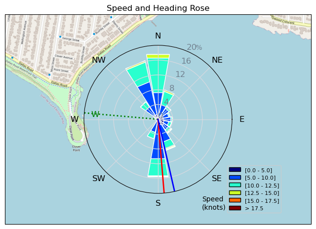
| Conditions | SW 10-17, flat to chop to 1ft swell |
| TOW | 1.2 hours |
| Toys | 115L JP Australia Foil Pro |
| 6.2m Cabrinha Mantis | |
| 2050sqcm Axis 1020mm Carbon Front Wing | |
| 900mm Axis Aluminum Mast | |
| Details | What an oddly fantastic session! Very light at the start as I tried to catch up with the Pope and Bobson. However, winds improved and got a good hour of well powered play at the top half of the bay. Kelp was scarce, but there were still a bit of wood, including the big Shin Crusher Log. I was consistently well powered as I played my board carving games and tried to get the other foilers into GoPro capture range. But, I was usually too slow. I stopped after an hour and let the late shift take the Bay Watch. Fun! [from Session Log on Sunday November 17, 2024] |
Speed (3s average)
| Speed | knots | km/h |
|---|---|---|
| Avg overall | 7.4 | 13.8 |
| Avg in motion | 8.9 | 16.5 |
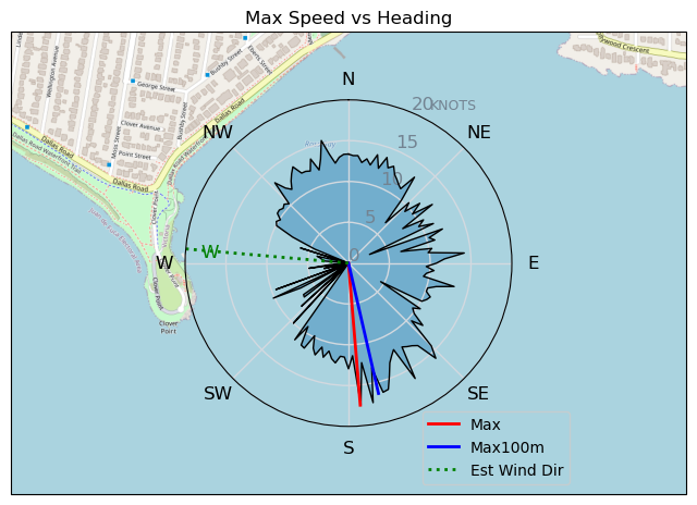
| Max | 17.5 | 32.3 |
| Max 100m | 14.8 | 27.4 |
| Max 250m | 11.8 | 21.9 |
| Max 500m | 11.0 | 20.3 |
| Max 2s | 17.5 | 32.3 |
| Max 10s | 16.1 | 29.8 |
| Max Alpha (500/50m) | 10.6 | 19.7 |
| Avg Foiling | 9.4 | 17.4 |
Times and Duration
| Start | Sun Nov 17, 10:49 AM |
| End | Sun Nov 17, 12:14 PM |
| Duration | 01:24:46 |
| In motion | 01:10:39 |
| Paused (< 3 km/h) | 00:13:55 |
| Foiling | 01:02:51 |
| Not Foiling (< 8 km/h) | 00:21:43 |
| Longest Foiling Segment | 00:11:10 (3.4 km) |
| Last Calculated | Mon Nov 18, 1:34 AM |
Track Information
| Distance | 19.5 km |
| # Trackpoints | 1917 |
| Avg Trackpoint distance | 10.2 m |
| Number of Turns | 56 |
| Foiling Turns (> 8 km/h) | 41 |
| Foiling Turn Percentage | 73% |


Category: Wingfoiling
5 hours ago

Created 5 hours ago
Highrocker |
Please register/login to download this track.
This track was downloaded 0 time(s). |
| 17 241117 Ross Bay |
| 25 Lordy lordy, its blowing more than forty?! |
| 26 SC |
| 27 IV a nice day to get worked in the shore break |
| 31 880HA Honeymoon Period |
Please wait while loading suggestions..
Please wait while loading suggestions..
You must login to post comments.