Still stinky stink bugs
slake - Wingfoiling |
Saturday August 19, 2023 12:53 PM |
| Spot | Nitinat Lk |
| Conditions | SW 15-20, 1' |
| TOW | 3.0 hours |
| Toys | Armstrong HA925 |
| Armstrong HA1125 | |
| Armstrong HS1850 | |
| 6m Nexen | |
| 4m Nexen | |
| 4m Duotone Slick | |
| 4'5" 60L Nexen | |
| 5'8" 110L Fanatic Sky Wing | |
| Details | Impossible to remember this stuff a week out but there is a faded memory and GPS track. I do remember Sat going out early with the big wing and small board at the first sniff of wind (wanted to stink bug start on flattish water). Probably about 15 min, or more, before there was enough power to get on foil on the small board. Instantly made up a lot of downwind lost ground. Did some ferrying upwind for the other half but she was pretty much staying upwind at this point. Went back to 4m wing/HA925 mid-afternoon and the wind backed off enough that I had to limp in. Memory foggy after that... [from Sailing Log on Saturday August 19, 2023] |
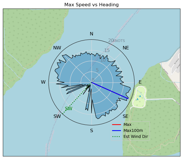
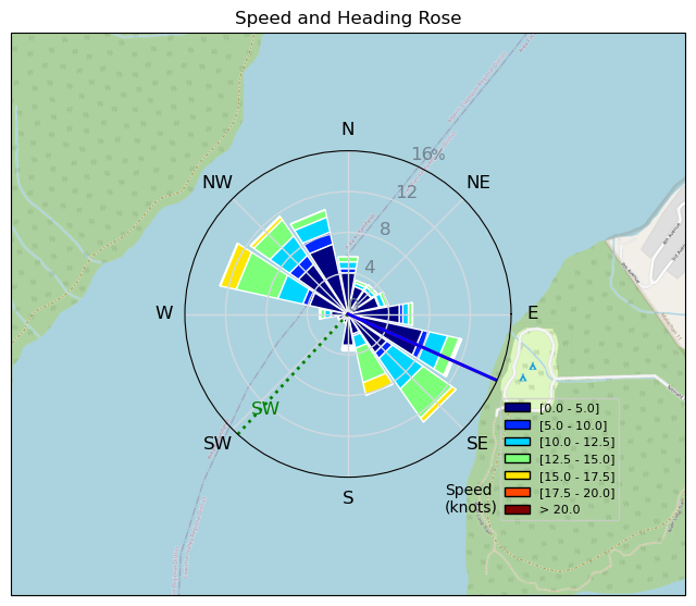
Speed (3s average)
| Speed | knots | km/h |
|---|---|---|
| Avg overall | 3.6 | 6.6 |
| Avg in motion | 8.6 | 16.0 |
| Max | 18.6 | 34.5 |
| Max 100m | 18.4 | 34.1 |
| Max 250m | 17.0 | 31.5 |
| Max 500m | 16.1 | 29.9 |
| Max 2s | 18.6 | 34.5 |
| Max 10s | 18.4 | 34.1 |
| Max Alpha (500/50m) | 15.0 | 27.7 |
| Avg Foiling | 12.1 | 22.4 |
Times and Duration
| Start | Sat Aug 19, 12:53 PM |
| End | Sat Aug 19, 6:24 PM |
| Duration | 05:30:48 |
| In motion | 02:16:55 |
| Paused (< 3 km/h) | 03:11:07 |
| Foiling | 01:17:48 |
| Not Foiling (< 8 km/h) | 04:10:14 |
| Last Calculated | Sat Aug 26, 1:25 PM |
Track Information
| Distance | 36.4 km |
| # Trackpoints | 5170 |
| Avg Trackpoint distance | 7.0 m |
| Number of Turns | 107 |
| Foiling Turns (> 8 km/h) | 42 |
| Foiling Turn Percentage | 39% |


Category: Wingfoiling
one year ago

Created one year ago
slake |
Please register/login to download this track.
This track was downloaded 0 time(s). |
| 52 241124 Willows |
| 58 WillowsQuickie |
| 50 Willows - Sunday Funday Woops |
| 49 Willows Mixed Bag |
| 42 Surprise Sunday ENE. |
Please wait while loading suggestions..
Please wait while loading suggestions..
You must login to post comments.