NN - Way up the Happy Lake
Bobson - Windfoiling |
Saturday August 26, 2023 12:02 PM |
| Spot | Nitinat Lk |
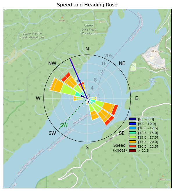
| Conditions | W 15-24, Wet |
| TOW | 4.5 hours |
| Toys | 255 Starboard Stabilizer |
| 85cm Starboard Mast | |
| 115+ Starboard Fuse | |
| 1000 Starboard Front Wing | |
| 6.0 Sailworks Flyer FR | |
| 4.5 Sailworks Flyer | |
| 150 Starboard Freeride | |
| Details | Looked promising 1st thing early, clear and light outflow. Schlogged for 15 mins to get to the wind then light 10-12 for first 45 mins. Then picked up to 15-20 so came back and changed from 6.0 to 4.5m. Got on the water at Noon, sailed till 5pm. Went up as far as I could twice with some good solid speed runs in the flat water. Sailed up there with Alain the first time and lone session the 2nd. So steady and flat up there. Love it!! Mr. Norrie and SlickMick made a surprise visits and I got to Windfoil with Wyatt Miller down at the bottom of the lake for 20 mins which was pretty cool He was throwing some turny-spinny moves. Tomorrow looks like it's gonna crank!! Grey and Rainbow both killing it on the Wings! BOBSON OUT!! [from Sailing Log on Saturday August 26, 2023] |
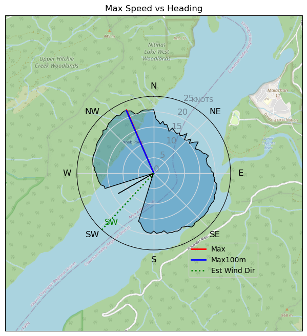
Speed (3s average)
| Speed | knots | km/h |
|---|---|---|
| Avg overall | 13.3 | 24.7 |
| Avg in motion | 15.6 | 28.9 |
| Max | 22.4 | 41.4 |
| Max 100m | 22.1 | 41.0 |
| Max 250m | 21.7 | 40.2 |
| Max 500m | 20.9 | 38.7 |
| Max 2s | 22.3 | 41.4 |
| Max 10s | 22.1 | 40.9 |
| Max Alpha (500/50m) | 18.6 | 34.5 |
| Avg Foiling | 16.8 | 31.1 |
Times and Duration
| Start | Sat Aug 26, 12:02 PM |
| End | Sat Aug 26, 5:26 PM |
| Duration | 05:23:47 |
| In motion | 04:36:47 |
| Paused (< 3 km/h) | 00:45:55 |
| Foiling | 04:12:23 |
| Not Foiling (< 8 km/h) | 01:10:19 |
| Longest Foiling Segment | 01:25:14 (45.5 km) |
| Last Calculated | Tue Oct 03, 10:29 AM |
Track Information
| Distance | 133.3 km |
| # Trackpoints | 16760 |
| Avg Trackpoint distance | 8.0 m |
| Number of Turns | 150 |
| Foiling Turns (> 8 km/h) | 143 |
| Foiling Turn Percentage | 95% |


Category: Windfoiling
one year ago

Created one year ago
Bobson |
Please register/login to download this track.
This track was downloaded 0 time(s). |
| 52 241124 Willows |
| 57 WillowsQuickie |
| 50 Willows - Sunday Funday Woops |
| 49 Willows Mixed Bag |
| 41 Surprise Sunday ENE. |
Please wait while loading suggestions..
Please wait while loading suggestions..
You must login to post comments.