Harkened
tweezer - Wingfoiling |
Tuesday November 07, 2023 2:17 PM |
| Spot | Ross Bay |
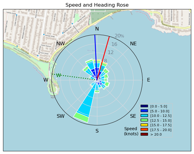
| Conditions | WSW 15-20, 2-4ft |
| TOW | 1.5 hours |
| Toys | 1038cm2 Axis ART 999 |
| 86cm Axis carbon mast v2 | |
| 56cm Axis Sillyshort Advance fuse | |
| 360/45 Axis 360/45 skinny | |
| 5 Cabrinha Mantis | |
| 4ft9 65l Appletree Custom | |
| Details | Decent swells even at the end of the flood. Wind held nicely for the crispy new 5m. Having fun and then saw Tyl's wing tumbling riderless, so beelined after it. Tried to tow it in using the board leash but it was too draggy. Moved the board leash up to my belt and was able to fly closer to shore but couldn't clear the point and I haven't practiced tacking or gybing with 2 wings, so opted for a rocky landing. Hauled everything in and got a lift back with Tyl. Almost relaunched, but too tired and darkness harkened. (is that a word?) [from Session Log on Tuesday November 07, 2023] |
Speed (3s average)
| Speed | knots | km/h |
|---|---|---|
| Avg overall | 6.8 | 12.5 |
| Avg in motion | 9.7 | 17.9 |
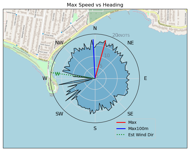
| Max | 17.6 | 32.5 |
| Max 100m | 16.1 | 29.8 |
| Max 250m | 15.2 | 28.1 |
| Max 500m | 14.5 | 26.9 |
| Max 2s | 17.5 | 32.4 |
| Max 10s | 16.4 | 30.5 |
| Max Alpha (500/50m) | 12.1 | 22.5 |
| Avg Foiling | 11.0 | 20.3 |
Times and Duration
| Start | Tue Nov 07, 2:17 PM |
| End | Tue Nov 07, 3:55 PM |
| Duration | 01:38:27 |
| In motion | 01:08:38 |
| Paused (< 3 km/h) | 00:29:47 |
| Foiling | 00:56:06 |
| Not Foiling (< 8 km/h) | 00:42:19 |
| Longest Foiling Segment | 00:10:16 (3.5 km) |
| Last Calculated | Tue Nov 07, 5:58 PM |
Track Information
| Distance | 20.5 km |
| # Trackpoints | 3872 |
| Avg Trackpoint distance | 5.3 m |
| Number of Turns | 96 |
| Foiling Turns (> 8 km/h) | 69 |
| Foiling Turn Percentage | 72% |


Category: Wingfoiling
one year ago

Created one year ago
tweezer |
Please register/login to download this track.
This track was downloaded 0 time(s). |
| 7 Swell beckons |
| 15 Clover week |
| 35 Double rainbowwww |
| 30 aCloverBalmyBombo |
| 28 Maytag day at IV 20241122 |
Please wait while loading suggestions..
Please wait while loading suggestions..
You must login to post comments.