NN - Thursday Windfoil
Bobson - Windfoiling |
Thursday May 16, 2024 1:44 PM |
| Spot | Nitinat Lk |
| Conditions | W 20-25, 1-2??? ers |
| TOW | 2.0 hours |
| Toys | 255 Starboard Stabilizer |
| 85cm Starboard Mast | |
| 900 Starboard Evolution Foil | |
| 1100 Starboard Evolution Foil | |
| 115 Starboard Evolution Fuse | |
| 4.5 Sailworks Flyer | |
| 150 Starboard Freeride | |
| Details | Pretty great day! No rain and some sunshine. Steady wind and water is not cold. Windfoilers today as no one here so stuck with what I know. I'll try Winging if the wind calms down. Road n was good. Started on the 1100cm2 front foil and when wind picked up to 25kts, went down to the 900cm2. Started to get gusty at 4pm so called it quits and cracked open an ice cold Corona. Hoping some more peeps show up. BOBSON OUT!! [from Session Log on Thursday May 16, 2024] |


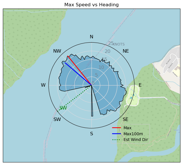
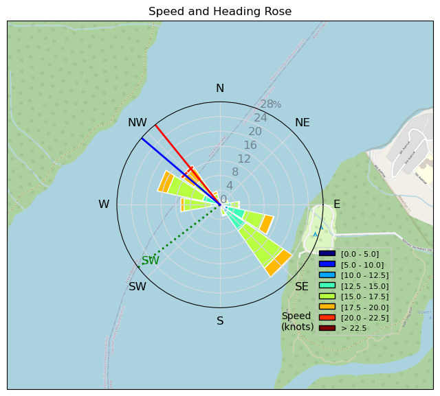
Distance: 51.6 kmTime: 02:18:35Max Speed (3s avg): 21.9 ktsMax Speed (no avg): 29.5 ktsMax Acceleration: 1.6 m/s²
Speed (3s average)
| Speed | knots | km/h |
|---|---|---|
| Avg overall | 12.1 | 22.4 |
| Avg in motion | 15.3 | 28.3 |
| Max | 22.0 | 40.7 |
| Max 100m | 20.8 | 38.5 |
| Max 250m | 20.2 | 37.5 |
| Max 500m | 19.6 | 36.4 |
| Max 2s | 21.9 | 40.5 |
| Max 10s | 20.8 | 38.5 |
| Max Alpha (500/50m) | 17.2 | 31.8 |
| Avg Foiling | 15.6 | 29.0 |
Times and Duration
| Start | Thu May 16, 1:44 PM |
| End | Thu May 16, 4:03 PM |
| Duration | 02:18:35 |
| In motion | 01:49:36 |
| Paused (< 3 km/h) | 00:28:39 |
| Foiling | 01:46:09 |
| Not Foiling (< 8 km/h) | 00:32:06 |
| Longest Foiling Segment | 01:04:00 (31.5 km) |
| Last Calculated | Mon May 20, 8:27 PM |
Track Information
| Distance | 51.6 km |
| # Trackpoints | 6615 |
| Avg Trackpoint distance | 7.8 m |
| Number of Turns | 83 |
| Foiling Turns (> 8 km/h) | 80 |
| Foiling Turn Percentage | 96% |


Category: Windfoiling
12 months ago

Created 12 months ago
Bobson Comments
|
Please register/login to download this track.
This track was downloaded 0 time(s). |
| 6 NN - 2025-04-25 - Winging on the Airbolt 135 |
| 26 RB - April 27 |
| 22 250428 Ross Bay |
| 49 Election day RB session |
| 41 Cruising the Bay |
Please wait while loading suggestions..
Please wait while loading suggestions..
You must login to post comments.