HowSloCanUgo
UnusuallyLargeRobin - Wingfoiling |
Sunday June 23, 2024 2:52 PM |
| Spot | Ross Bay |
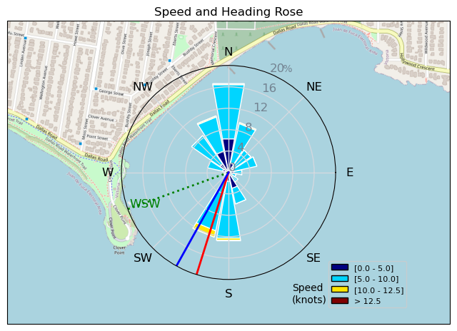
| Conditions | WSW 8-14, 1' |
| TOW | 1.0 hours |
| Toys | 187 lb / 85 kg Me Carbon-based Lifeform |
| PNG 1150 (1713cm2) Axis Front Foil | |
| 90cm Axis Alu Mast | |
| 425 P Axis Rear Foil/Stab | |
| 5.5m Gong Neutra Team Ed | |
| 5'8 128lt Indiana Wing Foil Carbon | |
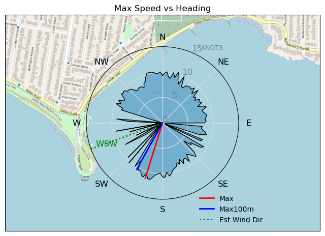
| Details | Caught the 3 to 4 shift. Forgot to turn on gps until halfway thru. Broke out the superlight wind gear, trusty old PNG1150, biggest stab 425, and the 128 Indiana board. Never creases to amaze me in how light a wind I can fly, and how slow I can keep flying on the 1150. Was even able to catch some runs flagged out on teeny slow slow bumps. [from Session Log on Sunday June 23, 2024] |
Speed (3s average)
| Speed | knots | km/h |
|---|---|---|
| Avg overall | 6.3 | 11.6 |
| Avg in motion | 7.5 | 14.0 |
| Max | 11.4 | 21.1 |
| Max 100m | 10.6 | 19.6 |
| Max 250m | 9.9 | 18.3 |
| Max 500m | 8.6 | 15.9 |
| Max 2s | 11.4 | 21.0 |
| Max 10s | 11.0 | 20.3 |
| Max Alpha (500/50m) | 8.2 | 15.1 |
| Avg Foiling | 8.0 | 14.8 |
Times and Duration
| Start | Sun Jun 23, 2:52 PM |
| End | Sun Jun 23, 3:23 PM |
| Duration | 00:30:25 |
| In motion | 00:25:20 |
| Paused (< 3 km/h) | 00:04:35 |
| Foiling | 00:22:24 |
| Not Foiling (< 8 km/h) | 00:07:31 |
| Longest Foiling Segment | 00:06:20 (1.5 km) |
| Last Calculated | Wed Jun 26, 6:18 PM |
Track Information
| Distance | 5.9 km |
| # Trackpoints | 1810 |
| Avg Trackpoint distance | 3.3 m |
| Number of Turns | 29 |
| Foiling Turns (> 8 km/h) | 20 |
| Foiling Turn Percentage | 69% |


Category: Wingfoiling
5 months ago

Created 5 months ago
UnusuallyLargeRobin |
Please register/login to download this track.
This track was downloaded 0 time(s). |
| 8 aCloverBalmyBombo |
| 10 Maytag day at IV 20241122 |
| 8 Bomba Bueno |
| 7 Log-a-slog |
| 8 East to SE and strong! |
Please wait while loading suggestions..
Please wait while loading suggestions..
You must login to post comments.