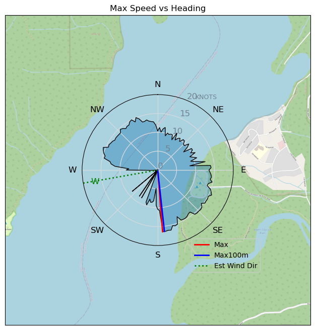
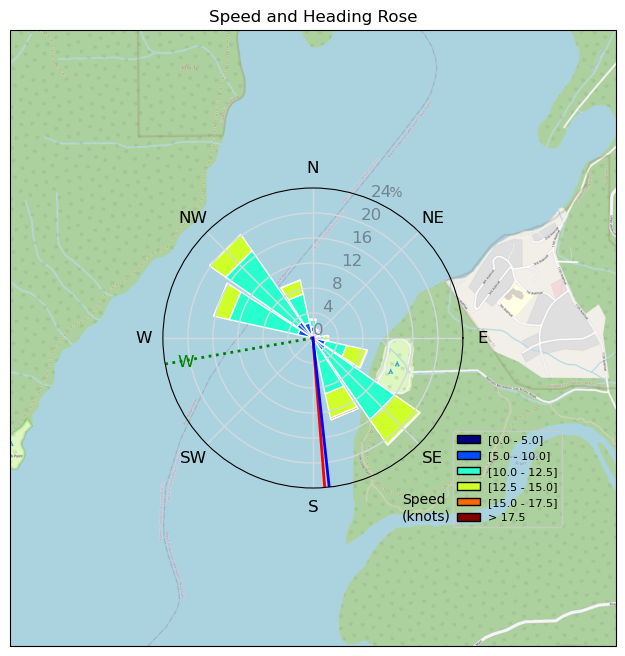
Nitinat Duke Session 20240713
davey_k - Kitesurfing |
Saturday July 13, 2024 3:02 PM |
| Spot | Nitinat Lk |
| Conditions | SSW 20-26, some chop out there |
| TOW | 4.0 hours |
| Toys | 52cm Ocean Rodeo Shift Bar (Gen 3) |
| 10 Ocean Rodeo Crave HL | |
| 230 Takoon Tiki | |
| 5'4" Ocean Rodeo Duke 3 | |
| Details | Two sessions again today. Again starting early in lighter wind with the Tiki and a 10m. Spent most of my time close to the launch area doing countless tacks. Left foot forward tacks are more successful than right foot forward attempts. I then went on a two tack upwind hike to Knob point and then on the far side I went straight downwind and then came in for a rest and lunch. Second session on the Duke and the 10m was a little hard because the lake was quite choppy. I searched the whole lake looking for smoother water and found some near the village. Bonus was some nice wind swell. I spent quite a bit of time there and then made a long charge up to Knob point. As I was heading there I noticed that the water was quite flat up past the Caycuse river. I came back to that after reaching the point. I spent some time doing tacks and then headed back in to land. Fantastic day. [from Session Log on Saturday July 13, 2024] |
Speed (3s average)
| Speed | knots | km/h |
|---|---|---|
| Avg overall | 9.1 | 16.8 |
| Avg in motion | 10.6 | 19.7 |
| Max | 16.4 | 30.4 |
| Max 100m | 16.0 | 29.6 |
| Max 250m | 15.4 | 28.4 |
| Max 500m | 15.2 | 28.2 |
| Max 2s | 16.4 | 30.3 |
| Max 10s | 16.1 | 29.8 |
| Max Alpha (500/50m) | 12.0 | 22.2 |
| Avg Planing | 11.3 | 21.0 |
Times and Duration
| Start | Sat Jul 13, 3:02 PM |
| End | Sat Jul 13, 5:31 PM |
| Duration | 02:28:10 |
| In motion | 02:06:20 |
| Paused (< 3 km/h) | 00:21:29 |
| Planing | 01:55:34 |
| Not Planing (< 8 km/h) | 00:32:15 |
| Longest Planing Segment | 00:15:03 (5.1 km) |
| Last Calculated | Sun Jul 14, 5:43 PM |
Track Information
| Distance | 41.4 km |
| # Trackpoints | 7237 |
| Avg Trackpoint distance | 5.7 m |
| Number of Turns | 72 |
| Planing Turns (> 8 km/h) | 47 |
| Planing Turn Percentage | 65% |


Category: Kitesurfing
5 months ago

Created 5 months ago
davey_k |
Please register/login to download this track.
This track was downloaded 0 time(s). |
| 30 Swell beckons |
| 27 Clover week |
| 37 Double rainbowwww |
| 31 aCloverBalmyBombo |
| 28 Maytag day at IV 20241122 |
Please wait while loading suggestions..
Please wait while loading suggestions..
You must login to post comments.