August 24 Lake Nitinath
JCH - Kitesurfing |
Saturday August 24, 2024 2:13 PM |
| Spot | Nitinat Lk |
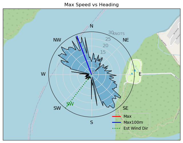
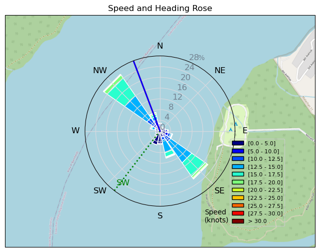
| Conditions | WSW 20-25, Mostly overcast |
| TOW | 2.8 hours |
| Toys | 150 Ocean rodeo Mako |
| 5.8 Dakin Liquid FORCE | |
| 11 Duotone NEO SLS | |
| Details | Overcast, wind from the coast pushed in and gave us a chance to go kiting. I first went out on my surfboard, but I had a difficult time to get upwind and I ripped the one strap I had. Not doing well without that strap. Changed to the Mako. Took me a while to get used to the Mako again. I think I prefer the Surfboard. The 11m NEO SLS was OK, I think I could have used the 12m. There were times the wind was weak, and I had difficulties to go upwind. Even with the Mako, I did not do that well going upwind. For some reason, without the front foot strap I loose control of the board. Need to learn ow to go strapless. [from Session Log on Saturday August 24, 2024] |
Speed (3s average)
| Speed | knots | km/h |
|---|---|---|
| Avg overall | 9.4 | 17.5 |
| Avg in motion | 12.4 | 22.9 |
| Max | 28.7 | 53.2 |
| Max 100m | 25.3 | 46.8 |
| Max 250m | 17.8 | 33.0 |
| Max 500m | 16.4 | 30.5 |
| Max 2s | 28.7 | 53.1 |
| Max 10s | 23.4 | 43.3 |
| Max Alpha (500/50m) | 15.4 | 28.5 |
| Avg Planing | 13.8 | 25.5 |
Times and Duration
| Start | Sat Aug 24, 2:13 PM |
| End | Sat Aug 24, 4:47 PM |
| Duration | 02:34:05 |
| In motion | 01:57:17 |
| Paused (< 3 km/h) | 00:29:54 |
| Planing | 01:40:23 |
| Not Planing (< 8 km/h) | 00:46:48 |
| Longest Planing Segment | 00:33:39 (14.7 km) |
| Last Calculated | Sat Aug 24, 9:36 PM |
Track Information
| Distance | 44.8 km |
| # Trackpoints | 9147 |
| Avg Trackpoint distance | 4.9 m |
| Number of Turns | 73 |
| Planing Turns (> 8 km/h) | 63 |
| Planing Turn Percentage | 86% |


Category: Kitesurfing
3 months ago
Created 3 months ago
JCH |
Please register/login to download this track.
This track was downloaded 0 time(s). |
Please wait while loading suggestions..
Please wait while loading suggestions..
You must login to post comments.