Upwind with Tweezer and Lightwind Fun
slake - Wingfoiling |
Thursday August 29, 2024 2:39 PM |
| Spot | Nitinat Lk |
| Conditions | SW 8-18, 1' |
| TOW | 2.8 hours |
| Toys | Armstrong HA925 |
| Armstrong HA1125 | |
| 6.1m Armstrong XPS | |
| 3.5m Armstrong XPS | |
| 5'5" 88L Armstrong Wing SUP | |
| Details | Looked like the wind might be light but first session was on a 3.5 m, and it was enough. Went up the lake with Tweezer but didn't get as far upwind as him and did not want to come off foil with the 3.5. Took a work break then back with the HA1125 and 6.1 m around 5 or 6 pm. I pumped up the wing at my campsite and someone said: "Are you pumping up to go out? The wind is dying and all wingers are coming off the water." Great second session. I can't believe there are bigger XPS wings for light wind. The 6.1 m is plenty massive and, while efficient, it is big to move during transitions...still tons of fun in the final session with the bigger wing and lightish conditions (maybe 10 knots, if that, but steady). The wing canopy is very tight for being so large. Hope it stays that way for some time!! [from Session Log on Thursday August 29, 2024] |
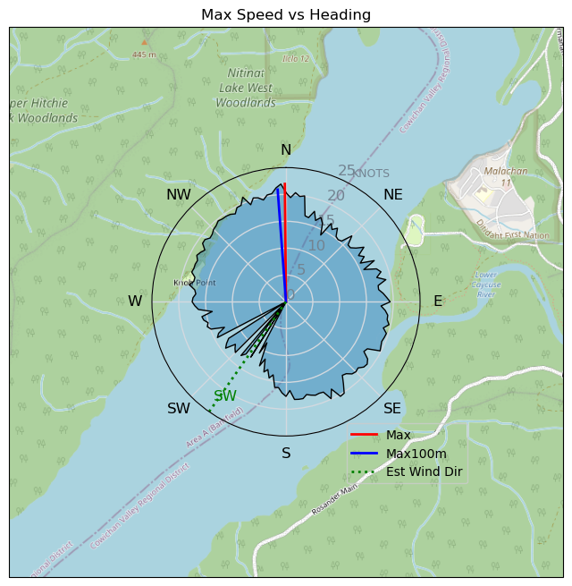
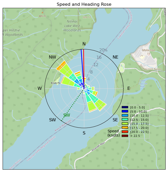
Speed (3s average)
| Speed | knots | km/h |
|---|---|---|
| Avg overall | 8.3 | 15.4 |
| Avg in motion | 13.6 | 25.3 |
| Max | 22.0 | 40.7 |
| Max 100m | 21.4 | 39.7 |
| Max 250m | 21.0 | 38.8 |
| Max 500m | 20.2 | 37.4 |
| Max 2s | 22.0 | 40.7 |
| Max 10s | 21.4 | 39.7 |
| Max Alpha (500/50m) | 15.7 | 29.1 |
| Avg Foiling | 14.3 | 26.5 |
Times and Duration
| Start | Thu Aug 29, 2:39 PM |
| End | Thu Aug 29, 7:14 PM |
| Duration | 04:35:32 |
| In motion | 02:48:13 |
| Paused (< 3 km/h) | 01:47:08 |
| Foiling | 02:37:55 |
| Not Foiling (< 8 km/h) | 01:57:26 |
| Longest Foiling Segment | 00:23:05 (10.8 km) |
| Last Calculated | Thu Aug 29, 9:08 PM |
Track Information
| Distance | 70.9 km |
| # Trackpoints | 4863 |
| Avg Trackpoint distance | 14.6 m |
| Number of Turns | 125 |
| Foiling Turns (> 8 km/h) | 115 |
| Foiling Turn Percentage | 92% |


Category: Wingfoiling
3 months ago

Created 3 months ago
slake |
Please register/login to download this track.
This track was downloaded 0 time(s). |
Please wait while loading suggestions..
Please wait while loading suggestions..
You must login to post comments.