OP on 3.5 m
slake - Wingfoiling |
Sunday September 01, 2024 11:50 AM |
| Spot | Nitinat Lk |
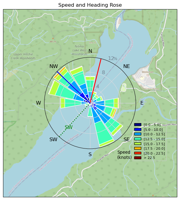
| Conditions | SW 15-30, 3-4' |
| TOW | 5.0 hours |
| Toys | Armstrong HA925 |
| 6.1m Armstrong XPS | |
| 3.5m Armstrong XPS | |
| 5'5" 88L Armstrong Wing SUP | |
| Details | Some very strong wind and fun waves. Way overpowered with a 3.5 m at times. Might need/want a smaller wing...at some point. Bigger news was I managed a 21.1 km 1:49 run in morning along Carmanah and Rosander Main (won't be in the wing GPS track :) but I sure as heck recorded it). It was a damn slog, even with music. Winging in nuking wind on the other hand, with a harness, was more relaxing. Edit/correction/update: in my selfish boasting on running I forgot the even bigger, more important, news that my SO is now confidently gybing, and easily sailing upwind. Pretty impressed for a non-board sports, non-water sports person. Great to see her winging!! Also, as far as I could tell she was last off Sep 1st, and was foiling around me after I no longer had enough power. [from Session Log on Sunday September 01, 2024] |
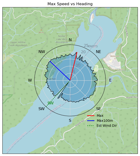
Speed (3s average)
| Speed | knots | km/h |
|---|---|---|
| Avg overall | 8.4 | 15.6 |
| Avg in motion | 12.0 | 22.1 |
| Max | 20.2 | 37.4 |
| Max 100m | 19.4 | 35.9 |
| Max 250m | 18.3 | 34.0 |
| Max 500m | 17.5 | 32.4 |
| Max 2s | 20.2 | 37.4 |
| Max 10s | 19.4 | 35.9 |
| Max Alpha (500/50m) | 16.5 | 30.5 |
| Avg Foiling | 12.9 | 23.9 |
Times and Duration
| Start | Sun Sep 01, 11:50 AM |
| End | Sun Sep 01, 6:55 PM |
| Duration | 07:04:45 |
| In motion | 04:59:48 |
| Paused (< 3 km/h) | 02:04:27 |
| Foiling | 04:29:47 |
| Not Foiling (< 8 km/h) | 02:34:28 |
| Longest Foiling Segment | 00:53:22 (21.9 km) |
| Last Calculated | Mon Sep 02, 8:57 AM |
Track Information
| Distance | 110.6 km |
| # Trackpoints | 9348 |
| Avg Trackpoint distance | 11.8 m |
| Number of Turns | 188 |
| Foiling Turns (> 8 km/h) | 158 |
| Foiling Turn Percentage | 84% |


Category: Wingfoiling
3 months ago

Created 3 months ago
slake |
Please register/login to download this track.
This track was downloaded 0 time(s). |
Please wait while loading suggestions..
Please wait while loading suggestions..
You must login to post comments.