SeptSunsetSesh
UnusuallyLargeRobin - Wingfoiling |
Wednesday September 25, 2024 6:01 PM |
| Spot | Ross Bay |
| Conditions | WSW 12-20, 1-2' |
| TOW | 1.5 hours |
| Toys | 187 lb / 85 kg Me Carbon-based Lifeform |
| 365/55 Skinny Axis Rear Foil/Stab | |
| Crazy Short (60.0cm) Axis Black Advanced Fuselage | |
| HPS 1050 (1460cm2) Axis Foil | |
| 90cm Axis Alu Mast | |
| 5.5m Gong Neutra Team Ed | |
| 75 lt Fanatic Sky Wing 5'0 | |
| Details | Watched the RB cam for most of the afternoon and finally spied the wind coming in late in the day. Headed down to a group that was mostly schlogging, but wind was threatening off in the distance to come in. Rigged big to hedge my bets and was apparently the correct call as it never really amped up. Pretty tame conditions, lots of loose kelp, some kelp rafts, and sticks/wood bobbing about. Beautiful sunset cruise. Pretty good crowd about 15ish. Tweezer doing stunts (behind back handle pass gybes), Tuna going too fast in the no wake zone, BWD off on his own west quest. BigJohn, Gus, and many others. Still in barefeet! [from Session Log on Wednesday September 25, 2024] |
Speed (3s average)
| Speed | knots | km/h |
|---|---|---|
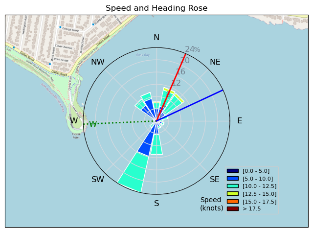
| Avg overall | 9.2 | 17.1 |
| Avg in motion | 9.6 | 17.8 |
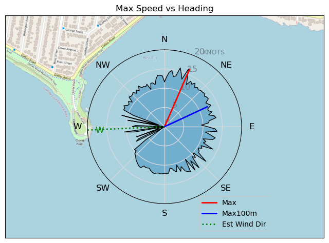
| Max | 16.2 | 30.0 |
| Max 100m | 13.1 | 24.2 |
| Max 250m | 12.2 | 22.5 |
| Max 500m | 11.5 | 21.3 |
| Max 2s | 16.0 | 29.7 |
| Max 10s | 13.9 | 25.7 |
| Max Alpha (500/50m) | 11.1 | 20.6 |
| Avg Foiling | 10.0 | 18.6 |
Times and Duration
| Start | Wed Sep 25, 6:01 PM |
| End | Wed Sep 25, 7:12 PM |
| Duration | 01:10:48 |
| In motion | 01:07:56 |
| Paused (< 3 km/h) | 00:02:43 |
| Foiling | 01:03:51 |
| Not Foiling (< 8 km/h) | 00:06:48 |
| Longest Foiling Segment | 00:25:54 (8.0 km) |
| Last Calculated | Thu Sep 26, 9:05 AM |
Track Information
| Distance | 20.1 km |
| # Trackpoints | 4247 |
| Avg Trackpoint distance | 4.7 m |
| Number of Turns | 59 |
| Foiling Turns (> 8 km/h) | 56 |
| Foiling Turn Percentage | 95% |


Category: Wingfoiling
one month ago

Created one month ago
UnusuallyLargeRobin |
Please register/login to download this track.
This track was downloaded 0 time(s). |
| 14 RB - Nov 11 2024 |
| 19 RB - Nov 14 2024 |
| 29 Nov RB |
| 34 RB - Terminator Eyes |
| 26 Clover and a gnarly shoreline |
Please wait while loading suggestions..
Please wait while loading suggestions..
You must login to post comments.