Unlucky.
TunaCan - Wingfoiling |
Friday October 04, 2024 4:21 PM |
| Spot | Ross Bay |
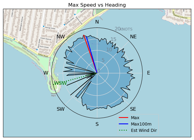
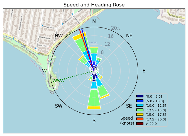
| Conditions | W 8-15, flat |
| TOW | 1.0 hours |
| Details | Arrived to minimal wind, and RB local paddleboarding, not a great sign. Chatted with Tugboat and RuppDogg and things seemed to turn around. Blue skies brought some wind and foiled right off the beach. Up and down wind, but fun following Tweezer around working on some backwind sailing. Booked it back to the beach to avoid a swim. I deflated my wing on the road by my truck, the valve shot off when I unscrewed it and it shot into the road where it was promptly driven over by a SUV - couldnt believe it. Anyways - no wind on the forecast :( [from Session Log on Friday October 04, 2024] |
Speed (3s average)
| Speed | knots | km/h |
|---|---|---|
| Avg overall | 9.2 | 17.0 |
| Avg in motion | 11.9 | 22.1 |
| Max | 17.7 | 32.7 |
| Max 100m | 16.7 | 31.0 |
| Max 250m | 15.1 | 28.0 |
| Max 500m | 14.2 | 26.3 |
| Max 2s | 17.5 | 32.4 |
| Max 10s | 17.0 | 31.4 |
| Max Alpha (500/50m) | 14.2 | 26.3 |
| Avg Foiling | 12.4 | 23.0 |
Times and Duration
| Start | Fri Oct 04, 4:21 PM |
| End | Fri Oct 04, 5:20 PM |
| Duration | 00:59:05 |
| In motion | 00:45:26 |
| Paused (< 3 km/h) | 00:11:48 |
| Foiling | 00:40:24 |
| Not Foiling (< 8 km/h) | 00:16:50 |
| Longest Foiling Segment | 00:07:08 (2.7 km) |
| Last Calculated | Wed Oct 09, 10:52 AM |
Track Information
| Distance | 16.7 km |
| # Trackpoints | 3446 |
| Avg Trackpoint distance | 4.9 m |
| Number of Turns | 63 |
| Foiling Turns (> 8 km/h) | 52 |
| Foiling Turn Percentage | 83% |


Category: Wingfoiling
one month ago

Created one month ago
TunaCan |
Please register/login to download this track.
This track was downloaded 0 time(s). |
| 33 241120 Willows |
| 40 Willows Bomb Session |
| 40 Shoot the Entrance |
| 30 CloverPartDeux |
| 24 Come back soon Bombo |
Please wait while loading suggestions..
Please wait while loading suggestions..
You must login to post comments.