Light&Easy
UnusuallyLargeRobin - Wingfoiling |
Friday October 11, 2024 3:31 PM |
| Spot | Cattle Pt |
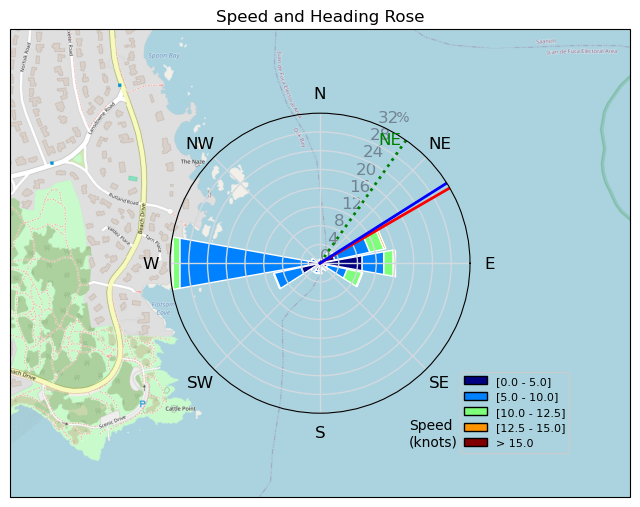
| Conditions | NW 8-11, Flat |
| TOW | 0.7 hours |
| Toys | 187 lb / 85 kg Me Carbon-based Lifeform |
| 425 P Axis Rear Foil/Stab | |
| Short (68cm) Axis Red Fuselage | |
| PNG 1150 (1713cm2) Axis Front Foil | |
| 90cm Axis Alu Mast | |
| 5.5m Gong Neutra Team Ed | |
| 75 lt Fanatic Sky Wing 5'0 | |
| Details | Scored a quick late afternoon session. Decided to check Cattle even though it didn't seem very windy at the house, on cams, or on latest wind reports. Arrived to see RupDog out flying so rigged up the big gear. Rupert was just about at the boat ramp schlogging in when I went out. The magic setup had me flying in no time and winging up toward the micro wind at the mouth of Cadboro Bay. Only came off foil once after a nice in a light patch near shore. Other than that Twas sweet! [from Session Log on Friday October 11, 2024] |
Speed (3s average)
| Speed | knots | km/h |
|---|---|---|
| Avg overall | 6.9 | 12.7 |
| Avg in motion | 7.7 | 14.3 |
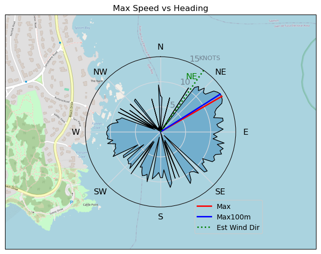
| Max | 14.1 | 26.2 |
| Max 100m | 12.8 | 23.7 |
| Max 250m | 11.4 | 21.1 |
| Max 500m | 10.3 | 19.1 |
| Max 2s | 14.1 | 26.1 |
| Max 10s | 13.5 | 25.0 |
| Max Alpha (500/50m) | 9.5 | 17.6 |
| Avg Foiling | 9.0 | 16.6 |
Times and Duration
| Start | Fri Oct 11, 3:31 PM |
| End | Fri Oct 11, 4:06 PM |
| Duration | 00:34:40 |
| In motion | 00:30:50 |
| Paused (< 3 km/h) | 00:03:15 |
| Foiling | 00:24:22 |
| Not Foiling (< 8 km/h) | 00:09:43 |
| Longest Foiling Segment | 00:20:20 (5.6 km) |
| Last Calculated | Fri Oct 11, 5:46 PM |
Track Information
| Distance | 7.4 km |
| # Trackpoints | 2080 |
| Avg Trackpoint distance | 3.5 m |
| Number of Turns | 24 |
| Foiling Turns (> 8 km/h) | 21 |
| Foiling Turn Percentage | 88% |


Category: Wingfoiling
6 weeks ago

Created 6 weeks ago
UnusuallyLargeRobin |
Please register/login to download this track.
This track was downloaded 0 time(s). |
| 33 241120 Willows |
| 40 Willows Bomb Session |
| 40 Shoot the Entrance |
| 30 CloverPartDeux |
| 24 Come back soon Bombo |
Please wait while loading suggestions..
Please wait while loading suggestions..
You must login to post comments.