Nitinat 081524
tugboat - Windfoiling |
Thursday August 15, 2024 1:55 PM |
| Spot | Nitinat Lk |
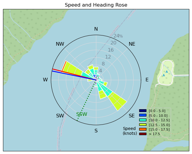
| Conditions | SW 20-35, flat-3ft |
| TOW | 3.8 hours |
| Toys | 3m KT Wing Air |
| 5m KT Wing Air | |
| 72L Omen Flux | |
| Details | I am documenting this to remember days when we almost miss our best experiences by questioning whether "it's worth the drive." I was looking at the RB forecast wondering whether it was worth going to Nitinat for what "could" be a good day. Glad I did. Amazing conditions. My best day there. Almost four hours. GPS malfunction left me with half a record of what was easily my longest amount of kms in one day. Started the AM with a 5m. Got a chance to take a few breaths with old friends Richard and John. And than back out on the water with a 4m for 2 mins before going back to get the 3m. Ballistic conditions all afternoon. Focused on foot switches, pumping and tacks in order of relative success. [from Session Log on Thursday August 15, 2024] |


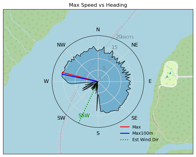
Distance: 31.2 kmTime: 01:42:10Max Speed (3s avg): 16.1 ktsMax Speed (no avg): 22.6 ktsMax Acceleration: 4.0 m/s²
Speed (3s average)
| Speed | knots | km/h |
|---|---|---|
| Avg overall | 9.9 | 18.3 |
| Avg in motion | 11.3 | 20.9 |
| Max | 16.1 | 29.7 |
| Max 100m | 15.4 | 28.5 |
| Max 250m | 14.3 | 26.6 |
| Max 500m | 13.7 | 25.3 |
| Max 2s | 16.0 | 29.6 |
| Max 10s | 15.6 | 29.0 |
| Max Alpha (500/50m) | 13.2 | 24.5 |
| Avg Foiling | 12.0 | 22.2 |
Times and Duration
| Start | Thu Aug 15, 1:55 PM |
| End | Thu Aug 15, 3:37 PM |
| Duration | 01:42:10 |
| In motion | 01:29:33 |
| Paused (< 3 km/h) | 00:10:50 |
| Foiling | 01:21:50 |
| Not Foiling (< 8 km/h) | 00:18:33 |
| Longest Foiling Segment | 00:17:39 (6.8 km) |
| Last Calculated | Thu Aug 15, 7:42 PM |
Track Information
| Distance | 31.2 km |
| # Trackpoints | 5710 |
| Avg Trackpoint distance | 5.5 m |
| Number of Turns | 97 |
| Foiling Turns (> 8 km/h) | 88 |
| Foiling Turn Percentage | 91% |


Category: Windfoiling
8 months ago

Created 8 months ago
tugboat Comments
|
Please register/login to download this track.
This track was downloaded 0 time(s). |
| 38 Pt.Holmes 04/06/25 |
| 70 CP - 2025-04-05 Morning Workout |
| 98 RB Starting to Feel Like Spring |
| 101 RB Tuna Catch and Release |
| 128 CP - 2025-04-02 Light Wind Big Foil |
Please wait while loading suggestions..
Please wait while loading suggestions..
You must login to post comments.