Big Swell A little late
tugboat - Wingfoiling |
Wednesday July 10, 2024 6:48 PM |
| Spot | Ross Bay |
| Conditions | W 18-20, 2-4ft |
| TOW | 1.0 hours |
| Toys | 1050cm 2 Omen Operator 1050 |
| 4m KT Wing Air DD | |
| 72L Omen Flux | |
| Details | I almost missed it. Sick people at home combined with work had be down on water end of evening. I was staring at the camera all afternoon missing the fun' Lol. Got out nonetheless and caught some sizeable swell. Lots of power out there at first and then, again, wind drop, the long swim in as wind died out entirely leaving six or so stranded way out. biggest problem today with seaweed. There were several long 100 strung-out blobs that were increasingly hard to get around without getting snagged. Anyway, short and sweet! [from Session Log on Wednesday July 10, 2024] |
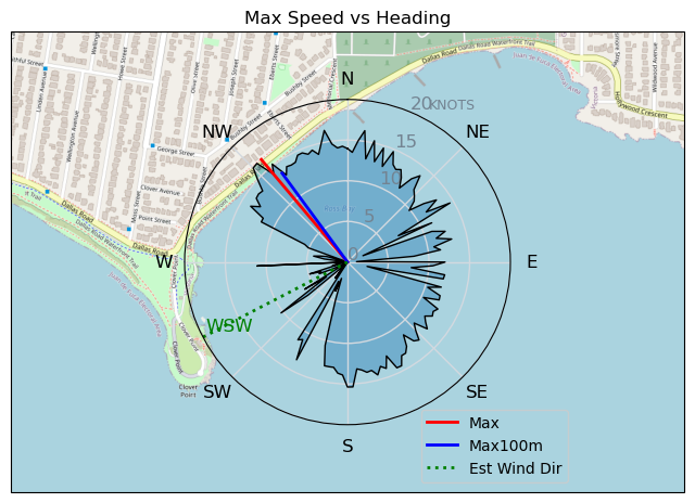
Speed (3s average)
| Speed | knots | km/h |
|---|---|---|
| Avg overall | 5.9 | 11.0 |
| Avg in motion | 9.1 | 16.9 |
| Max | 16.5 | 30.5 |
| Max 100m | 13.7 | 25.3 |
| Max 250m | 12.9 | 23.8 |
| Max 500m | 12.4 | 23.0 |
| Max 2s | 16.5 | 30.5 |
| Max 10s | 13.9 | 25.8 |
| Max Alpha (500/50m) | 12.0 | 22.3 |
| Avg Foiling | 11.4 | 21.1 |
Times and Duration
| Start | Wed Jul 10, 6:48 PM |
| End | Wed Jul 10, 7:46 PM |
| Duration | 00:57:53 |
| In motion | 00:37:41 |
| Paused (< 3 km/h) | 00:13:18 |
| Foiling | 00:26:16 |
| Not Foiling (< 8 km/h) | 00:24:43 |
| Longest Foiling Segment | 00:05:24 (2.0 km) |
| Last Calculated | Tue Jul 16, 9:58 AM |
Track Information
| Distance | 10.6 km |
| # Trackpoints | 3114 |
| Avg Trackpoint distance | 3.4 m |
| Number of Turns | 42 |
| Foiling Turns (> 8 km/h) | 21 |
| Foiling Turn Percentage | 50% |


Category: Wingfoiling
4 months ago

Created 4 months ago
tugboat |
Please register/login to download this track.
This track was downloaded 0 time(s). |
Please wait while loading suggestions..
Please wait while loading suggestions..
You must login to post comments.