Quick Clover
TunaCan - Wingfoiling |
Wednesday January 24, 2024 9:25 AM |
| Spot | Clover Pt |
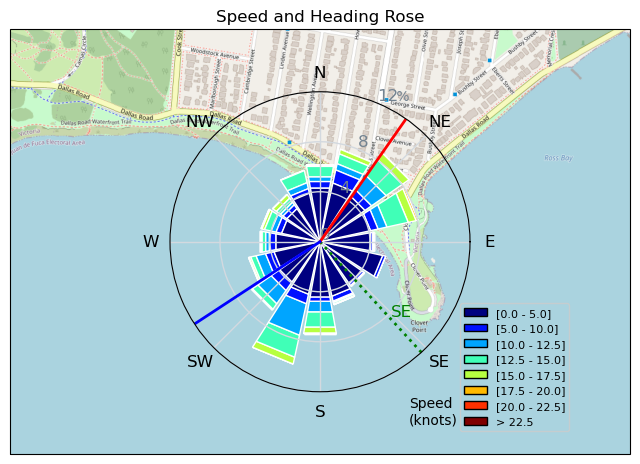
| Conditions | SE 10-25, 3-4 |
| TOW | 1.0 hours |
| Details | Showed up at 9am with the wind and rain going hard. Puffdaddy out doing HUGE airs. Ryan was just finishing up, had an epic session. Winddoc was just heading out paddling over massive shore break. Got really excited, pumped 3.5m and got out there. Launched up at boat ramp as high tide was making usual launch a death trap. PuffDaddy towed me out so i didn't have to paddle from the lee - Thanks PD! Wind was very gusty, and was overpowered and over foiled most the time, but did manage to get 1 long and great ride down to staircase - almost thought it was going to close out on me! Wind died shortly after and did walk of shame. Grabbed 5m but didnt last more than 10mins. Fun times. [from Session Log on Wednesday January 24, 2024] |
Speed (3s average)
| Speed | knots | km/h |
|---|---|---|
| Avg overall | 5.7 | 10.6 |
| Avg in motion | 6.7 | 12.5 |
| Max | 22.2 | 41.2 |
| Max 100m | 18.9 | 35.0 |
| Max 250m | 17.1 | 31.8 |
| Max 500m | 15.0 | 27.8 |
| Max 2s | 21.8 | 40.3 |
| Max 10s | 18.9 | 35.0 |
| Max Alpha (500/50m) | 14.7 | 27.2 |
| Avg Foiling | 11.2 | 20.7 |
Times and Duration
| Start | Wed Jan 24, 9:25 AM |
| End | Wed Jan 24, 10:30 AM |
| Duration | 01:05:16 |
| In motion | 00:55:46 |
| Paused (< 3 km/h) | 00:08:52 |
| Foiling | 00:24:30 |
| Not Foiling (< 8 km/h) | 00:40:08 |
| Longest Foiling Segment | 00:09:26 (3.8 km) |
| Last Calculated | Wed Jan 24, 3:36 PM |
Track Information
| Distance | 11.6 km |
| # Trackpoints | 3724 |
| Avg Trackpoint distance | 3.1 m |
| Number of Turns | 87 |
| Foiling Turns (> 8 km/h) | 22 |
| Foiling Turn Percentage | 25% |


Category: Wingfoiling
10 months ago

Created 10 months ago
TunaCan |
Please register/login to download this track.
This track was downloaded 0 time(s). |
| 11 Clover week |
| 34 Double rainbowwww |
| 30 aCloverBalmyBombo |
| 28 Maytag day at IV 20241122 |
| 21 Bomba Bueno |
Please wait while loading suggestions..
Please wait while loading suggestions..
You must login to post comments.