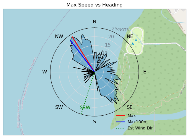
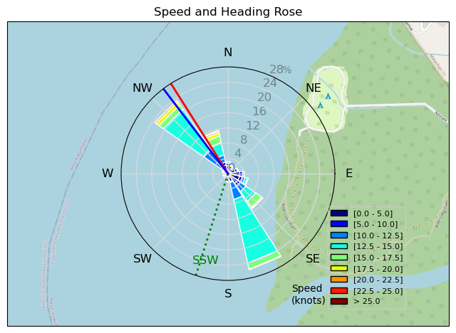
Lake Nitinaht, June 8
JCH - Kitesurfing |
Saturday June 08, 2024 4:03 PM |
| Spot | Nitinat Lk |
| Conditions | NW 15-22, Partly sunny, becoming OC |
| TOW | 0.8 hours |
| Toys | 13 Duotone Juice DLab |
| 10 Duotone NEO | |
| 132/40 North Jamie | |
| Details | Initially went out with the 13m, and that was a disaster. I did not correctly attach a steering line' it came off during launch. Fortunately, nothing bad happen to me or the kite. Cleaned up the mess, went out again. Now the wind picked up to the point I could not handle the 13m. I am lucky I made it back to the beach without an incident. Got my 10m out, had a good session and then the wind died suddenly. I was fortunate, I was sufficiently upwind so I could make it back to the beach without having to walk. Not my best session, but all in all, OK. Need to level up' next time. [from Session Log on Saturday June 08, 2024] |
Speed (3s average)
| Speed | knots | km/h |
|---|---|---|
| Avg overall | 9.5 | 17.7 |
| Avg in motion | 12.4 | 23.1 |
| Max | 23.5 | 43.6 |
| Max 100m | 22.2 | 41.1 |
| Max 250m | 19.1 | 35.4 |
| Max 500m | 15.3 | 28.4 |
| Max 2s | 23.3 | 43.1 |
| Max 10s | 22.1 | 40.9 |
| Max Alpha (500/50m) | 14.2 | 26.2 |
| Avg Planing | 13.1 | 24.2 |
Times and Duration
| Start | Sat Jun 08, 4:03 PM |
| End | Sat Jun 08, 4:43 PM |
| Duration | 00:40:32 |
| In motion | 00:31:05 |
| Paused (< 3 km/h) | 00:06:24 |
| Planing | 00:28:39 |
| Not Planing (< 8 km/h) | 00:08:50 |
| Longest Planing Segment | 00:13:02 (5.1 km) |
| Last Calculated | Sat Jun 08, 10:05 PM |
Track Information
| Distance | 11.9 km |
| # Trackpoints | 2415 |
| Avg Trackpoint distance | 4.9 m |
| Number of Turns | 43 |
| Planing Turns (> 8 km/h) | 19 |
| Planing Turn Percentage | 44% |


Category: Kitesurfing
6 months ago
Created 6 months ago
JCH |
Please register/login to download this track.
This track was downloaded 0 time(s). |
| 40 Swell beckons |
| 36 Clover week |
| 42 Double rainbowwww |
| 32 aCloverBalmyBombo |
| 28 Maytag day at IV 20241122 |
Please wait while loading suggestions..
Please wait while loading suggestions..
You must login to post comments.